Tag: satellite

Harnessing new high-resolution satellite imagery to plant breeding

In plant breeding, efforts to increase the rate of genetic gains and enhance crop resilience to the effects of climate change are often limited by the inaccessibility and costs of phenotyping methods. The recent rapid development of sensors, image-processing technology and data analysis has provided new opportunities for multiple scales phenotyping methods and systems. Among these, satellite imagery may represent one of the best ways to remotely monitor trials and nurseries planted in multiple locations, while standardizing protocols and reducing costs.

This is because relevant data collected as part of crop phenotyping can be generated from satellite images. For instance, the sensors onboard the SkySat satellite constellation of Planet Labs have four spectral bands—blue, green, red, and infrared—which can be used to calculate the normalized difference vegetation index (NDVI), which is a measure of vegetation and its greenness, and various canopy traits like ground cover, leaf area index and chlorosis. It can also be used to monitor plot establishment and phenological parameters.
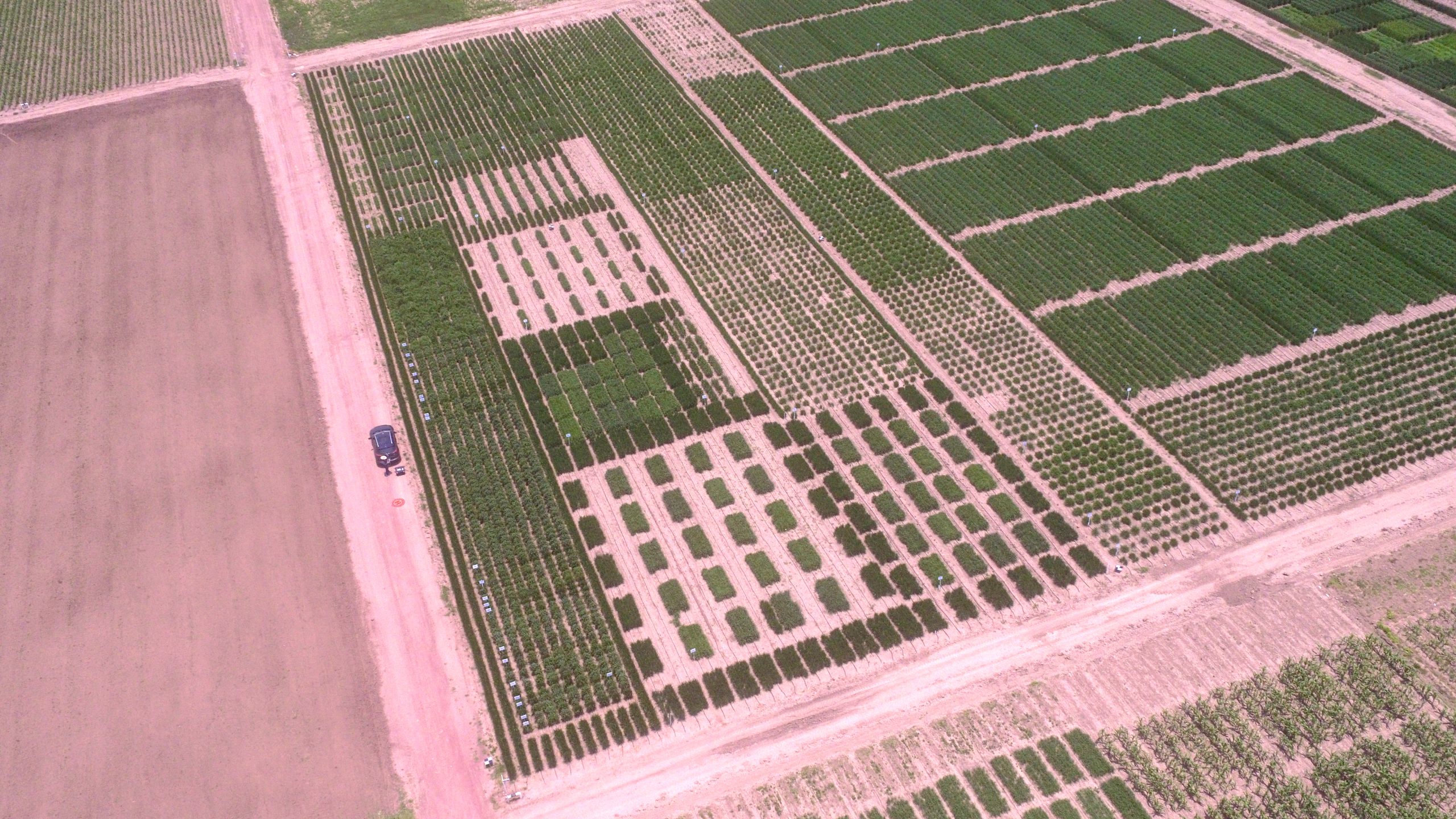
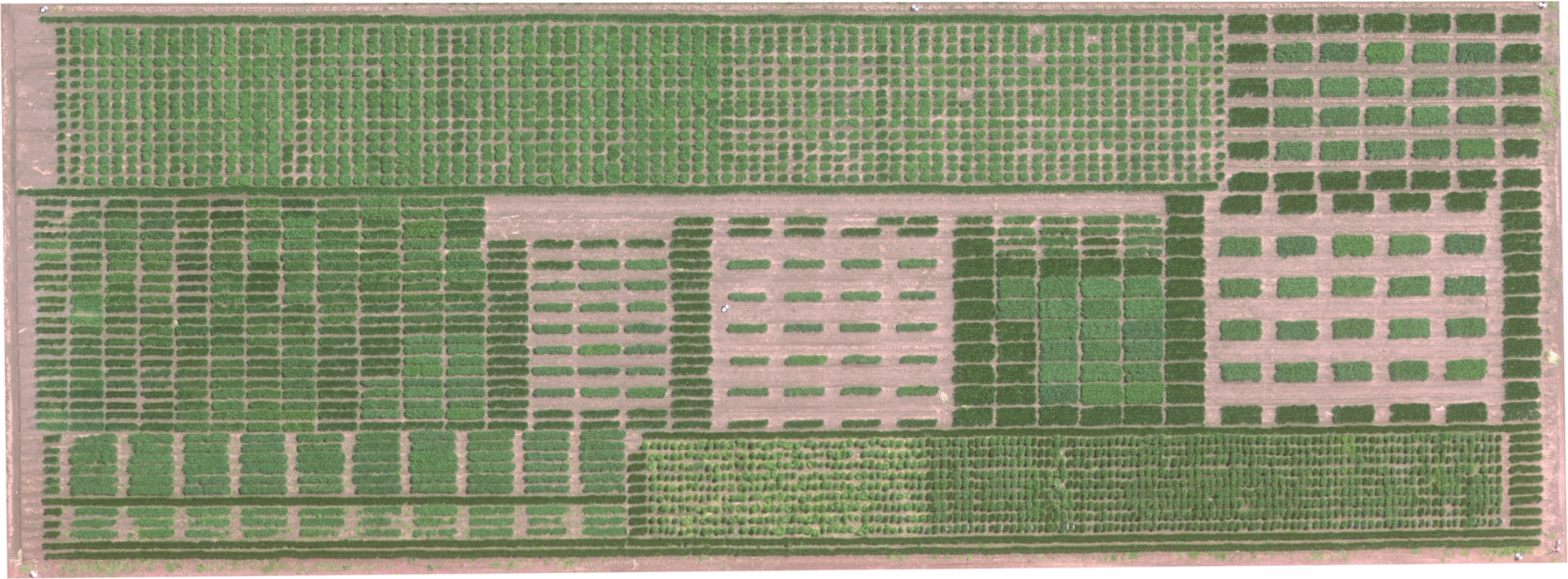
High-resolution RGB orthomosaic of wheat experiments, assessing the effect of plot size and spacing in the spectral signature, collected from SkySat satellite images. (Photo: Gilberto Thompson)

The use of satellite-based phenotyping in breeding trials has typically been restricted by low resolution, high cost and long intervals between fly-overs. However, the advent of a new generation of high-resolution satellites—such as the SkySat constellation—now offers multispectral images at a 0.5m resolution with close to daily acquisition attempts on any place on Earth. This could be a game changer in terms of the scale at which yield trials can be conducted, enabling more precise variety placement and thereby increasing genetic diversity across farmer’s fields and reducing the probability of disease epidemics. It could also revolutionize the capacity for research in realistic field conditions, since traits can be measured throughout the cycle in a highly standardized way, over multiple sites at low cost. For example, an image which covers 25 km2 can monitor an entire research station at a cost of about US$300.

To test the suitability of this technology, a team of researchers from CIMMYT set out to evaluate the reliability of SkySat NDVI estimates for maize and wheat breeding plots of different sizes and spacing, as well as testing its capacity for detecting seasonal changes and genotypic differences.

Both their initial findings, recently published in Frontiers in Plant Science, and more recently acquired data, show that the SkySat satellites can be used to monitor plots commonly used in wheat and maize nurseries. While wheat yield plots usually are 1.2m wide, maize plots tend to consist of at least two rows, resulting in a width of 1.5m. Plot length ranges from 2-4m. The authors also discuss on other factors to be considered when extracting and interpreting satellite data from yield trials, such as plot spacing.

Through the successful collection of six satellite images in Central Mexico during the rainy season and parallel monitoring of a maize trial in Zimbabwe, the researchers demonstrate the flexibility of this tool. Beyond the improvement of spatial resolution, the researchers suggest that the next challenge will be the development and fine-tuning of operational procedures that ensure high quality, standardized data, allowing them to harness the benefits of the modern breeding triangle, which calls for the integration of phenomics, enviromics and genomics, to accelerate breeding gains.

Read the full study: Satellite imagery for high-throughput phenotyping in breeding plots

This research was supported by the Foundation for Food and Agriculture Research, the CGIAR Research Program on Maize, the CGIAR Research Program on Wheat, and the One CGIAR Initiatives on Digital Innovation, F2R-CWANA, and Accelerated Breeding.
Microsatellite data can help double impact of agricultural interventions

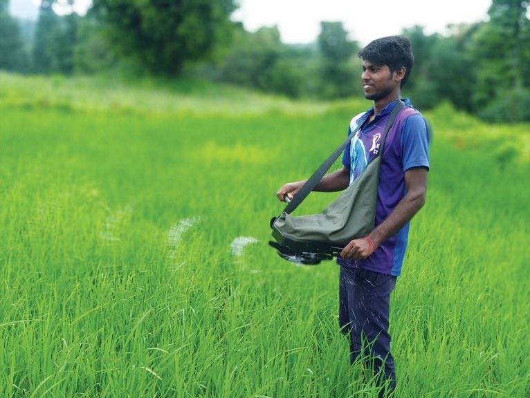
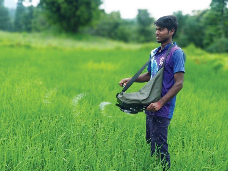
A young man uses a precision spreader to distribute fertilizer in a field. (Photo: Mahesh Maske/CIMMYT)

Data from microsatellites can be used to detect and double the impact of sustainable interventions in agriculture at large scales, according to a new study led by the University of Michigan (U-M).

By being able to detect the impact and target interventions to locations where they will lead to the greatest increase of yield gains, satellite data can help increase food production in a low-cost and sustainable way.

According to the team of researchers from U-M, the International Maize and Wheat Improvement Center (CIMMYT), and Stanford and Cornell universities, finding low-cost ways to increase food production is critical, given that feeding a growing population and increasing the yields of crops in a changing climate are some of the greatest challenges of the coming decades.

“Being able to use microsatellite data, to precisely target an intervention to the fields that would benefit the most at large scales will help us increase the efficacy of agricultural interventions,” said lead author Meha Jain, assistant professor at the U-M School for Environment and Sustainability.

Microsatellites are small, inexpensive, low-orbiting satellites that typically weigh 100 kilograms or less.

“About 60-70% of total world food production comes from smallholders, and they have the largest field-level yield gaps,” said Balwinder Singh, senior researcher at the International Maize and Wheat Improvement Center (CIMMYT).

To show that the low-cost microsatellite imagery can quantify and enhance yield gains, the researchers conducted their study in smallholder wheat fields in the Eastern Indo-Gangetic Plains in India.

They ran an experiment on 127 farms using a split-plot design over multiple years. In one half of the field, the farmers applied nitrogen fertilizer using hand broadcasting, the typical fertilizer spreading method in this region. In the other half of the field, the farmers applied fertilizer using a new and low-cost fertilizer spreader.

To measure the impact of the intervention, the researchers then collected the crop-cut measures of yield, where the crop is harvested and weighed in field, often considered the gold standard for measuring crop yields. They also mapped field and regional yields using microsatellite and Landsat satellite data.

They found that without any increase in input, the spreader resulted in 4.5% yield gain across all fields, sites and years, closing about one-third of the existing yield gap. They also found that if they used microsatellite data to target the lowest yielding fields, they were able to double yield gains for the same intervention cost and effort.

“Being able to bring solutions to the farmers that will benefit most from them can greatly increase uptake and impact,” said David Lobell, professor of earth system science at Stanford University. “Too often, we’ve relied on blanket recommendations that only make sense for a small fraction of farmers. Hopefully, this study will generate more interest and investment in matching farmers to technologies that best suit their needs.”

The study also shows that the average profit from the gains was more than the amount of the spreader and 100% of the farmers were willing to pay for the technology again.

Jain said that many researchers are working on finding ways to close yield gaps and increase the production of low-yielding regions.

“A tool like satellite data that is scalable and low-cost and can be applied across regions to map and increase yields of crops at large scale,” she said.

Read the full study:
The impact of agricultural interventions can be doubled by using satellite data

The study is published in the October issue of Nature Sustainability. Other researchers include Amit Srivastava and Shishpal Poonia of the International Maize and Wheat Improvement Center in New Delhi; Preeti Rao and Jennifer Blesh of the U-M School of Environment and Sustainability; Andrew McDonald of Cornell; and George Azzari and David Lobell of Stanford. 


For more information, or to arrange interviews, please contact CIMMYT’s media team.

European Space Agency selects CIMMYT to pilot new remote sensing project

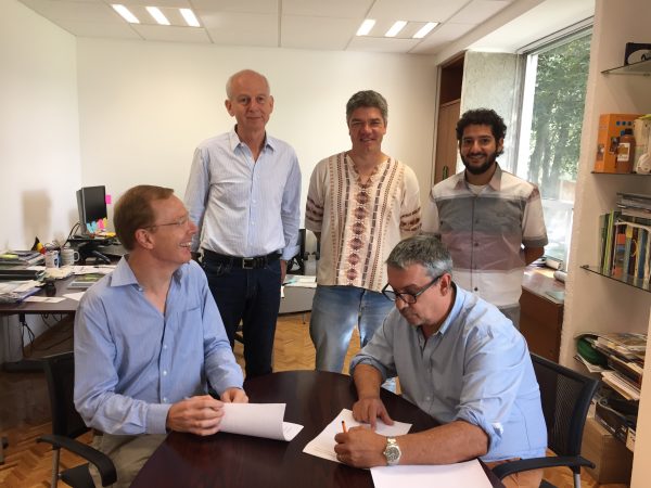
Signing ceremony (L-R) with Pierre Defourny, Urs Schulthess, Kai Sonder, Bruno Gérard and Francelino Rodrigues giving CIMMYT access to the pilot version of the Sen2-Agri processing system and receive training on its use. Photo: Liliana Díaz Ramírez

EL BATAN, Mexico (CIMMYT) – The International Maize and Wheat Improvement Center (CIMMYT) has been selected by the European Space Agency (ESA) to have access to the pilot version of the Sen2-Agri processing system and receive training on its use.

As an ESA “champion user,” CIMMYT will test the ESA prototype system in Bangladesh and Mexico. These two sites cover a wide range of farming systems, from the large wheat fields of the Yaqui Valley to a more diverse system in Bangladesh, where parcel sizes can be as small as 0.05 hectares and farmers grow two to three crops per year on a single field.

“The great unmanned aerial vehicle (UAV) expertise acquired by CIMMYT is very complementary to the full exploitation of the new satellite generation capabilities,” says Pierre Defourny, professor at the Université catholique de Louvain in Belgium who is leading the Sen2-Agri project. “CIMMYT’s two cases will generate products that will support our joint efforts for wheat blast monitoring in Bangladesh and improve data availability for GreenSat in Mexico.”

In the early days of remote sensing, limited availability of data was a major constraint for putting the data to good use. Basic processing of the coarse data was also time consuming and tedious.

Fortunately, this has greatly changed in recent years. Open and free satellite data, such as Landsat 8 and Sentinel 1 & 2, allow for almost weekly coverages at resolutions as fine as 10 meters. Thanks to this new speed and precision, users can now focus on applying the data, deriving information products even for small holder farmers in remote areas.

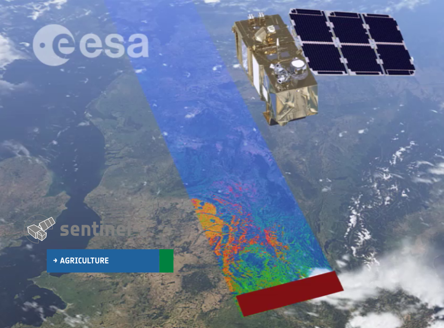
The Sentinel 2 satellites have a swath width of 290 km. Sentinel-2A is already operational, while Sentinel-2B will be launched in the spring of 2018. Together, they will be able to cover the Earth every 5 days.

For example, the CIMMYT-led STARS project in Bangladesh developed an irrigation scheduling app called PANI, which uses remotely sensed data to estimate crop water use. From this data the farmer receives a simple text message on their cell phone that gives recommendations as to whether a particular field needs to be irrigated or not.

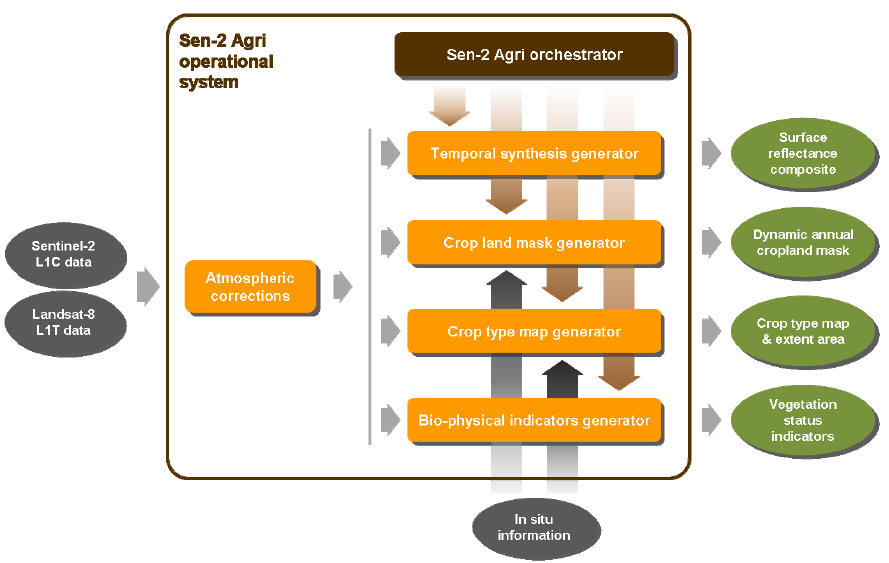
Sen2-Agri is unique compared to other systems in that it simplifies and automates satellite data processing. The system allows for semi-automated generation of products, such as cropland detection, crop classification, normalized difference vegetation index (NDVI) and leaf area index (LAI) based on images taken periodically by satellites Sentinel-2 and Landsat 8.

A signing ceremony was held on 15 August, 2016 to seal the cooperation between ESA and CIMMYT. Bruno Gérard, Director of CIMMYT’s Sustainable Intensification Program, sees this agreement as a fundamental game changer for CIMMYT’s geo-spatial work.

“Sen2-Agri will give CIMMYT access to high spatial and temporal resolution quality imagery and related ‘know-how,’ which in turn will enable us to further develop partnership with top-notch institutions in the earth observation field,” says Gérard.

Interface of the Sen2-Agri system, which allows for a semi-automated generation of cropland, crop type, LAI and NDVI maps.

The benefits of the Sen2-Agri are likely to far extend beyond the Yaqui Valley and Bangladesh. After the pilot phase of this project, the high-resolution imagery gathered could be applied to other areas CIMMYT projects are implemented.

In combination with bio-physical and socio-economic data, this will allow CIMMYT and other organizations to improve monitoring and evaluation, better assess and understand changes and shocks in crop-based farming systems and improve technology targeting across farmer communities.

The Sen2-Agri test program is being coordinated by Urs Schulthess. Please feel free to contact him at u.schulthess@cgiar.org if you have questions about or suggestions for future applications of the system.