Healthier soils, plant nutrition and improved land management contribute to more productive and profitable smallholder enterprises. The Guiding Acid Soil Management Investments in Africa (GAIA) project will address key knowledge gaps related to soil health and improved agronomy. It will use scalable innovations to provide reliable, timely and actionable data and insights on soil health and crop performance, at farm and regional levels.
Novel diagnostic approaches, data assets, decision aids and better farm management practices are increasingly being scaled and integrated with other data, products and services. These services can be integrated with solution-focused, bundled services that support farmers in their timely management and operational decisions. They can also be integrated with input delivery systems, including digitally enabled agricultural advisory systems.
Key expected results in the next five years include:
National soil information services fully integrated with functioning agronomy research pipelines within key international and national research organizations of at least seven focus countries in sub-Saharan Africa and SA.
Soil information services solutions are integrated with agricultural advisory services into overall decision agriculture platforms at the national level.
Innovative diagnostic tools and decision aids are increasingly used at farm and regional level.
All investments routinely apply FAIR (findable, accessible, interoperable, reusable) data principles and practices.
The vision of success of this project is the rehabilitation of acid soils at scale in East Africa — thanks to data-driven and spatially-explicit recommendations — leading to maximized (and inclusive) returns on investment for farmers, private companies and governments. While the analysis and outputs will be targeted to the specific needs of partner counties (Ethiopia, Kenya, Rwanda and Tanzania), the methodology, workflows and much of the analysis will be of relevance for other countries in the region. While the specific focus of the project is on acid soils, the frameworks will be adaptable and applicable to other soil health and geospatial agronomic challenges. The ultimate goal is sustainable intensification of African smallholder farming systems.
In line with its vision and goal, GAIA will deliver three primary outcomes:
Increase depth and utility of data and evidence related to acid soil management in the region.
Provide support to governments and the private sector to stimulate investment in acid soil management in the region.
Improve access and use of data related to acid soil management in the region.
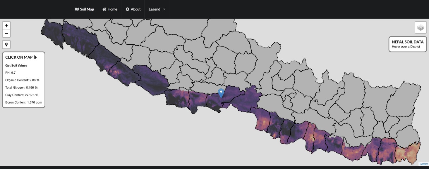
A new digital soil map for Nepal provides access to location-specific information on soil properties for any province, district, municipality or a particular area of interest. The interactive map provides information that will be useful to make new crop- and site-specific fertilizer recommendations for the country.
Produced by the International Maize and Wheat Improvement Center (CIMMYT), in collaboration with Nepal Agricultural Research Council’s (NARC) National Soil Science Research Center (NSSRC), this is the first publicly available soil map in South Asia that covers the entire country.
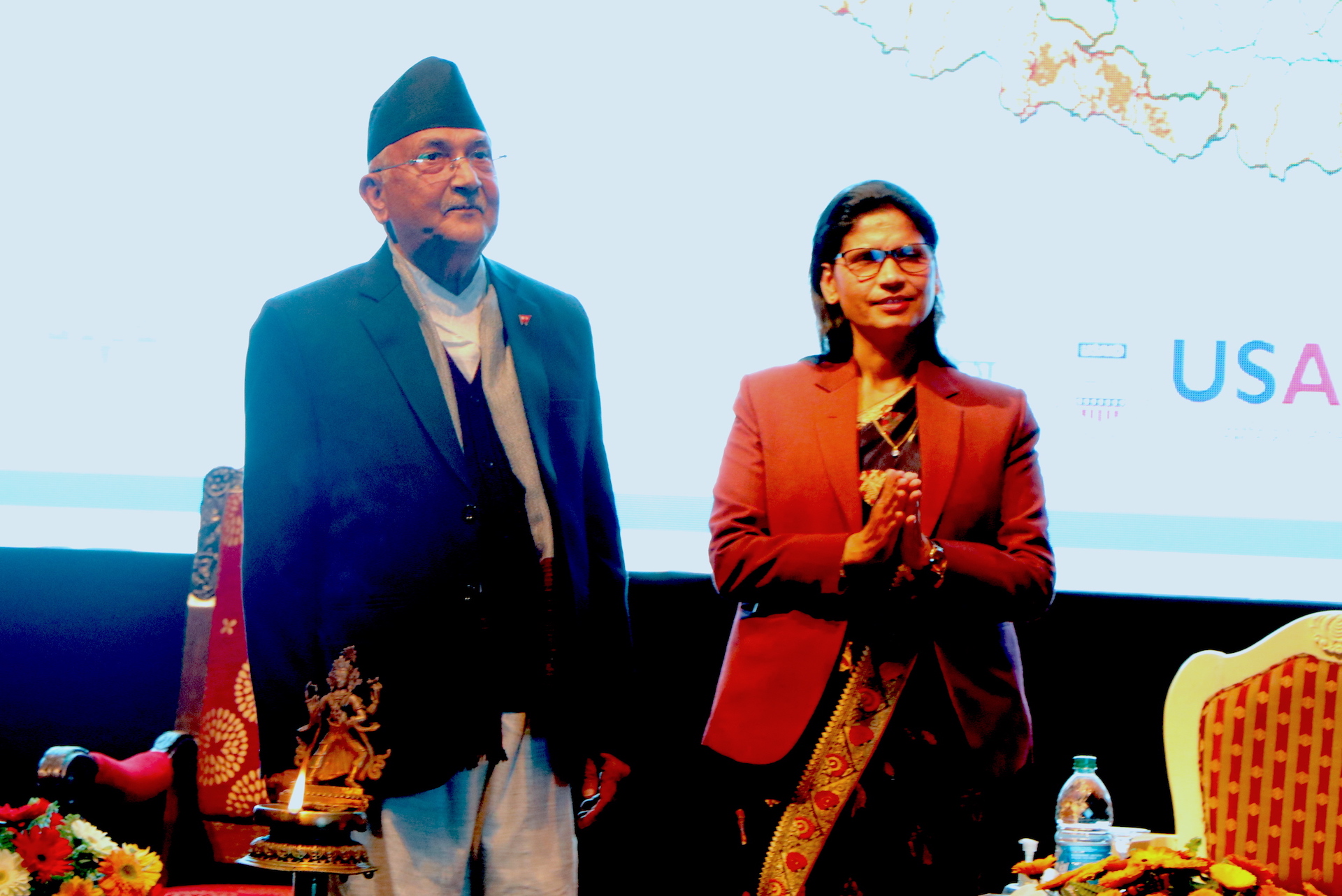
The Prime Minister of Nepal, K.P. Sharma Oli, officially launched the digital soil map at an event on February 24, 2021. Oli highlighted the benefits the map would bring to support soil fertility management in the digital era in Nepal. He emphasized its sustainability and intended use, mainly by farmers.
CIMMYT and NSSRC made a live demonstration of the digital soil map. They also developed and distributed an informative booklet that gives an overview of the map’s major features, operation guidelines, benefits, management and long-term plans.
The launch event was led by the Ministry of Agriculture and Livestock Development and organized in coordination with NARC, as part of the Nepal Seed and Fertilizer (NSAF) project, implemented by CIMMYT. More than 200 people participated in the event, including government officials, policymakers, scientists, professors, development partner representatives, private sector partners and journalists. The event was also livestreamed.
Better decisions
Immediately after the launch of the digital soil map, its CPU usage grew up to 94%. Two days after the launch, 64 new accounts had been created, who downloaded different soil properties data in raster format for use in maps and models.
The new online resource was prepared using soil information from 23,273 soil samples collected from the National Land Use Project, Central Agricultural Laboratory and Nepal Agricultural Research Council. The samples were collected from 56 districts covering seven provinces. These soil properties were combined with environmental covariates (soil forming factors) derived from satellite data and spatial predictions of soil properties were generated using advanced machine learning tools and methods.
The platform is hosted and managed by NARC, who will update the database periodically to ensure its effective management, accuracy and use by local government and relevant stakeholders. The first version of the map was finalized and validated through a workshop organized by NSSRC among different stakeholders, including retired soil scientists and university professors.
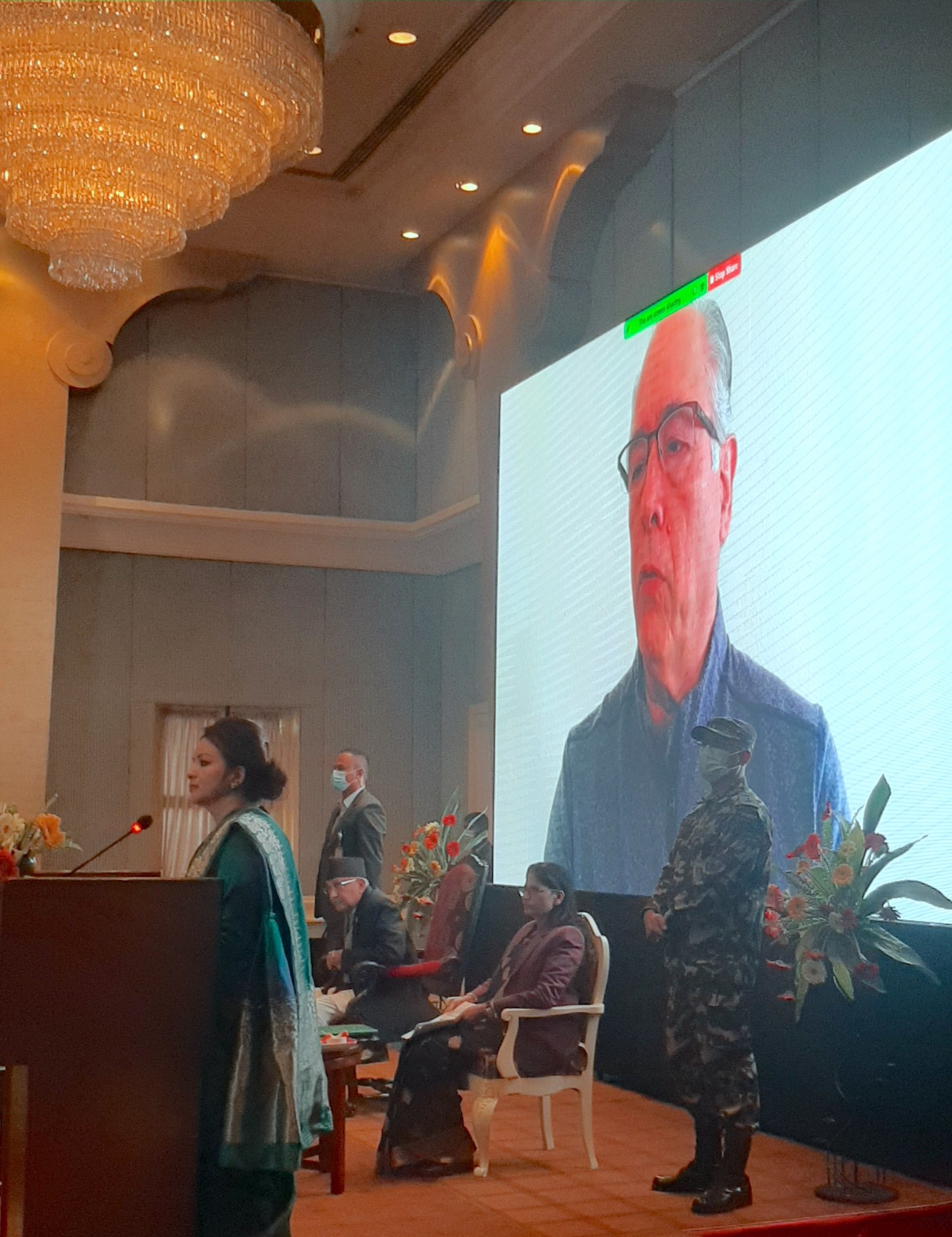
Ivan Ortiz-Monasterio, principal scientist at CIMMYT, shared his remarks in a video message. (Photo: Shashish Maharjan/CIMMYT)
“The ministry can use the map to make more efficient management decisions on import, distribution and recommendation of appropriate fertilizer types, including blended fertilizers. The same information will also support provincial governments to select suitable crops and design extension programs for improving soil health,” said Padma Kumari Aryal, Minister of Agriculture and Livestock Development, who chaired the event. “The private sector can utilize the acquired soil information to build interactive and user-friendly mobile apps that can provide soil properties and fertilizer-related information to farmers as part of commercial agri-advisory extension services,” she said.
“These soil maps will not only help to increase crop yields, but also the nutritional value of these crops, which in return will help solve problems of public health such as zinc deficiency in Nepal’s population,” explained Ivan Ortiz-Monasterio, principal scientist at CIMMYT, in a video message.
Yogendra Kumar Karki, secretary of the Ministry of Agriculture and Livestock Development, presented the program objectives and Deepak Bhandari, executive director of NARC, talked about the implementation of the map and its sustainability. Special remarks were also delivered by USAID Nepal’s mission director, the secretary of Livestock, scientists and professors from Tribhuwan University, the International Fertilizer Development Center (IFDC) and the International Centre for Integrated Mountain Development (ICIMOD).
K.P. Sharma Oli (left), Prime Minister of Nepal, and Padma Kumari Aryal, Minister of Agriculture and Livestock Development, launch the digital soil map. (Photo: Shashish Maharjan/CIMMYT)
Benefits of digital soil mapping
Soil properties affect crop yield and production. In Nepal, access to soil testing facilities is rather scarce, making it difficult for farmers to know the fertilizer requirement of their land. The absence of a well-developed soil information system and soil fertility maps has been lacking for decades, leading to inadequate strategies for soil fertility and fertilizer management to improve crop productivity. Similarly, existing blanket-type fertilizer recommendations lead to imbalanced application of plant nutrients and fertilizers by farmers, which also negatively affects crop productivity and soil health.
This is where digital soil mapping comes in handy. It allows users to identify a domain with similar soil properties and soil fertility status. The digital platform provides access to domain-specific information on soil properties including soil texture, soil pH, organic matter, nitrogen, available phosphorus and potassium, and micronutrients such as zinc and boron across Nepal’s arable land.
Farmers and extension agents will be able to estimate the total amount of fertilizer required for a particular domain or season. As a decision-support tool, policy makers and provincial government can design and implement programs for improving soil fertility and increasing crop productivity. The map also allows users to identify areas with deficient plant nutrients and provide site-specific fertilizer formulations; for example, determining the right type of blended fertilizers required for balanced fertilization programs. Academics can also obtain periodic updates from these soil maps and use it as a resource while teaching their students.
As digital soil mapping advances, NSSRC will work towards institutionalizing the platform, building awareness at the province and local levels, validating the map, and establishing a national soil information system for the country.
KATHMANDU, Nepal (CIMMYT) — The International Maize and Wheat Improvement Center (CIMMYT) is working with Nepal’s Soil Management Directorate and the Nepal Agricultural Research Council (NARC) to aggregate historic soil data and, for the first time in the country, produce digital soil maps. The maps include information on soil PH, organic matter, total nitrogen, clay content and boron content. Digital soil mapping gives farmers and natural resource managers easy access to location-specific information on soil properties and nutrients, so they can make efficient and localized management decisions.
As part of CIMMYT’s Nepal Seed and Fertilizer (NSAF) project, researchers used new satellite imagery that enabled the resolution of the maps to be increased from 1×1 km to 250×250 m. They have updated the web portal to make it more user friendly and interactive. When loaded onto a smartphone, the map can retrieve the soil properties information from the user’s exact location if the user is within areas with data coverage. The project team is planning to produce maps for the whole country by the end of 2019.
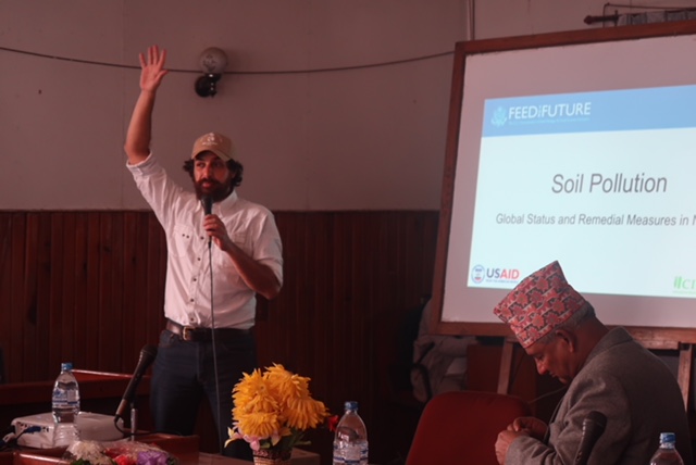
CIMMYT scientist David Guerena talks about the role of the new digital maps to combat soil fertility problems in Nepal.
At a World Soil Day event in Nepal, CIMMYT soil scientist David Guerena presented the new digital soil maps to scientists, academics, policymakers and other attendees. Guerena explained the role this tool can play in combatting soil fertility problems in Nepal.
These interactive digital maps are not simply visualizations. They house the data and analytics which can be used to inform site-specific integrated soil fertility management recommendations.
The first high-resolution digital soil maps for the Terai region have been produced with support from the data assets from the National Land Use Project, developed by Nepal’s Ministry of Agriculture and Livestock Development. These maps will be used to guide field programming of the NSAF project, drive the development of market-led fertilizer products, and inform and update soil management recommendations. The government of Nepal can use the same information to align policy with the needs of farmers and the capacity of local private seed and fertilizer companies.
In 2017, 16 scientists from Nepal’s Soil Management Directorate, NARC and other institutions attended an advanced digital soil mapping workshop where they learned how to use different geostatistical methods for creating soil maps. This year, as part of the NSAF project, four NARC scientists attended a soil spectroscopy training workshop and learned about digitizing soil data management and using advanced spectral methods to convert soil information into fertilizer recommendations.
Soil data matters
Soil properties have a significant influence on crop growth and the yield response to management inputs. For farmers, having access to soil information can make a big difference in the adoption of integrated soil fertility management.
Farmer motivation and decision-making relies heavily on the perceived likeliness of obtaining a profitable return at minimized risk. This largely depends on the yield response to management inputs, such as improved seeds and fertilizers, which depends to a large extent on site-specific soil properties and variation in agro-ecological conditions. Therefore, quantitative estimates of the yield response to inputs at a given location are essential for estimating the risks associated with these investments.
The Nepal Seed and Fertilizer project is funded by the United States Agency for International Development (USAID) and is a flagship project in Nepal. The objective of the NSAF is to build competitive and synergistic seed and fertilizer systems for inclusive and sustainable growth in agricultural productivity, business development and income generation in Nepal.


 KATHMANDU, Nepal (CIMMYT) — The International Maize and Wheat Improvement Center (CIMMYT) is working with Nepal’s Soil Management Directorate and the Nepal Agricultural Research Council (NARC) to aggregate historic soil data and, for the first time in the country, produce