Tag: apps & digital tools

Seeds go digital

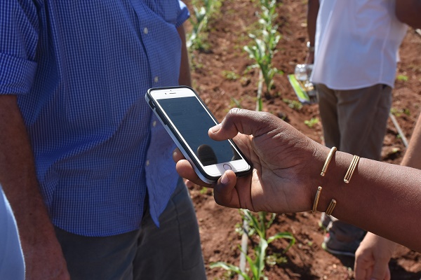
Seed Assure app testing in the field in Kiboko, Kenya. Photo credit: CIMMYT.
Seed Assure app testing in the field in Kiboko, Kenya. (Photo: CIMMYT)

Many Kenyan maize farmers are busy preparing their seed stock for the next planting season. Sowing high quality seeds of stress-tolerant varieties is a cost-effective way for African smallholder farmers to boost their harvests while being resilient to evolving crop pests and diseases as well as an erratic climate. However, even if a majority of farmers buy their seeds, they are often of dubious quality or of old, outdated varieties, which do not cope well against increasing drought and heat shocks or emerging diseases.

Insufficient seed quality control

The African seed sector has long been plagued by counterfeit seeds and a complex and costly certification process, which hampers access to better, higher-yielding, wide-ranging varieties for farmers.

Since the 1990s, national agencies could not keep up with the seed trade growth to handle the certification processes. Backlogs of certification requests and erroneous seed checks make it costly for private seed companies to produce and commercialize new varieties. As a result, maize varieties grown by farmers in sub-Saharan Africa are old: 28 years old on average for hybrids and up to 40 years old for open-pollinated varieties.

“A lot of the national certification systems in the region are overwhelmed. They do not have enough seed inspectors with proper training and tools to carry out compliance checks effectively and in a timely manner. The licensing, labeling and branding protocols and regulations are equally not in full force, and much of the work still needs to be digitized. This slows the entire process,” said Kate Fehlenberg, Drought Tolerant Maize for Africa Seed Scaling (DTMASS) Project Manager at the International Maize and Wheat Improvement Center (CIMMYT), at a recent Common Market for Eastern and Southern Africa (COMESA) seed policies’ harmonization event in Nairobi.

Go digital

To solve this certification bottleneck, seed actors are looking at digital solutions for faster, more accurate seed quality checks for both seed producers and regulators. One Kenyan company, Cellsoft Ltd., has developed SeedAssure, a cloud-based platform that enables digital seed inspections. Data necessary for quality seed production, pest and disease surveillance, and the required checks to apply for a commercial license can be shared in real-time on a common platform that links seed companies, inspectors and local authorities.  Such a tool not only enables optimal quality in seed production, but expedites the licensing, certification and trade processes with traceable data records.

SeedAssure is rapidly being rolled out across eastern and southern Africa with support across the seed value chain. This includes regional trade bodies like COMESA and the Southern African Development Community (SADC), national regulators such as the Seed Control and Certification Institute (SCCI), to research and development organizations like CIMMYT and the Alliance for a Green Revolution in Africa (AGRA). So far, 15 seed companies in seven countries in the region have been testing SeedAssure.

Transboundary data-sharing to boost regional seed trade
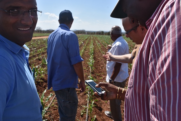
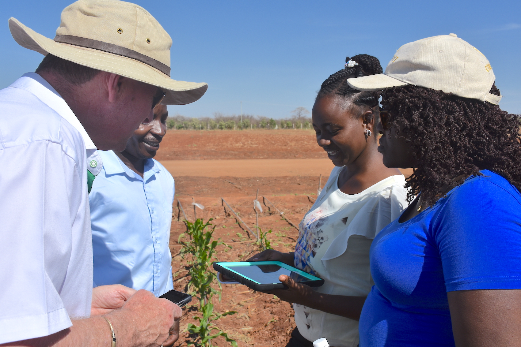
Kinyua Madhan from Zamseed and Nicolai NASECO testing SeedAssure on smartphone in the field in Kiboko, Kenya. Photo credit: CIMMYT.
Visitors test SeedAssure on a smartphone during a field visit in Kiboko, Kenya. (Photo: CIMMYT)

To boost regional seed trade, all actors along the seed value chain and across the region must embrace this digital revolution and “speak the same language”. This means adopting the same rules to identify and register a new variety, and using a common platform to easily share data between countries.

Currently, despite efforts to harmonize seed trade policies across the region, such as the COMESA Seed Harmonization Implementation Program (COMSHIP), passed in 2014, most countries still use different protocols to name and register seed varieties. One variety could have a different name in each country it is sold in. Data used for quality control are still often on paper rather than online, with each country performing its own tests. Seed companies must apply for new variety registration, with new data for each country they operate in. This all costs them time and money.

Adopting a unique identifier for seed products and digitalization can help alleviate this harmonization issue, easing comparable data sharing across border. Since November 2017, CIMMYT has adopted a Variety Identification Number (VIN) system. It is like a unique barcode for each variety which contains information about the organization that produced the variety, the year of release, the crop and specific traits such as drought-tolerance, the country where it is produced, etc. SADC and COMESA have just adopted this VIN system. COMSHIP is setting digital seed variety catalogues using the VIN, and soon regional seed labels. It will facilitate cross-border seed trade and help track seed fraud.

The  2019 Global Forum for Food and Agriculture (GFFA) held this week in Berlin is debating how digitalization is transforming the farming sector. This is particularly relevant for the African seed sector as digital innovations could make seed certification and quality control cheaper, faster and more transparent, while narrowing the space for fake seed. Seed companies would then be encouraged to release more new improved varieties, and ultimately accelerate our research impact for African farmers.
Reducing high yield gaps with decision-support apps

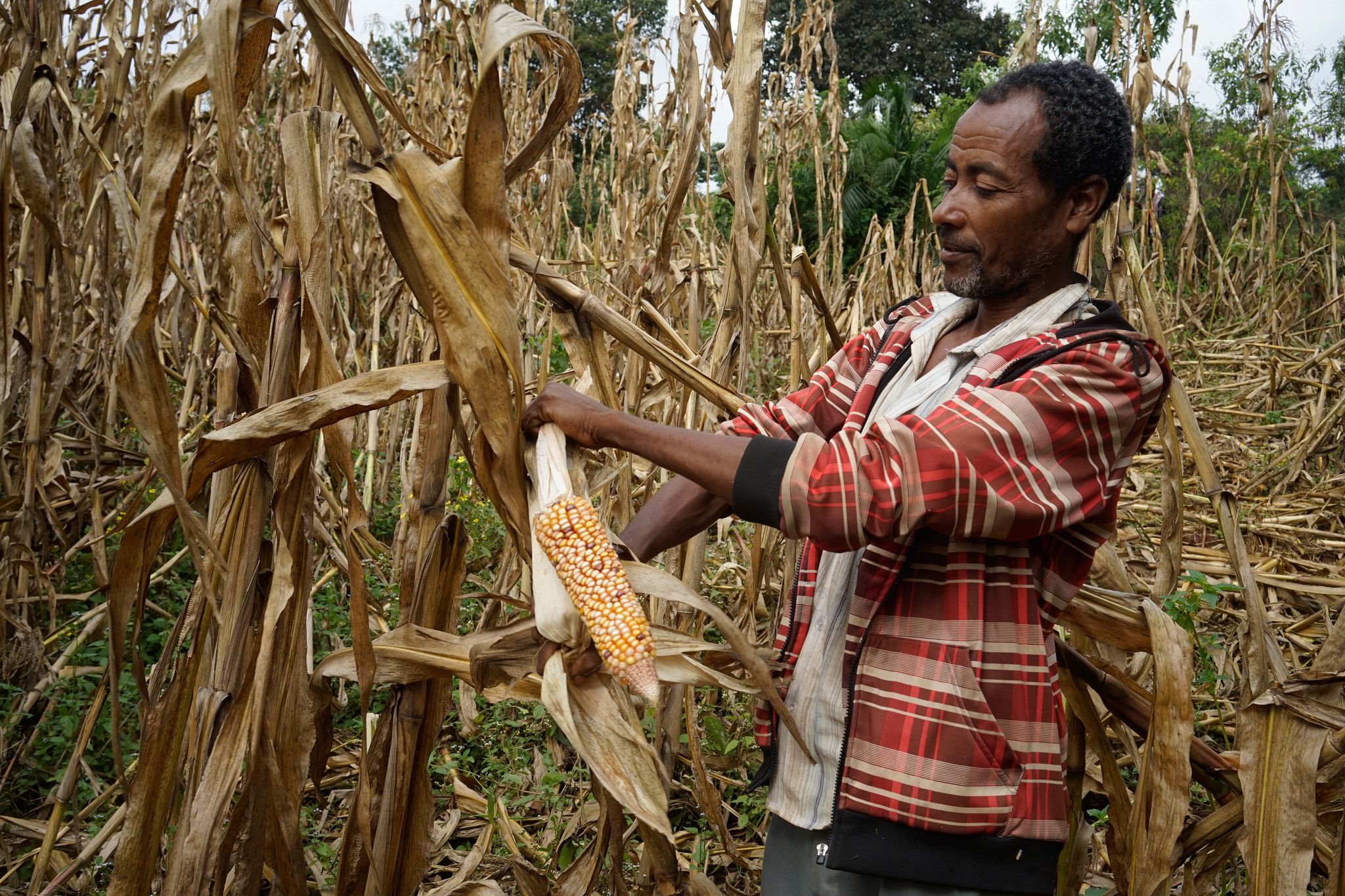
Farmer Gudeye Leta harvests his local variety maize in Dalecho village, Gudeya Bila district, Ethiopia. (Photo: Peter Lowe/CIMMYT)

Ethiopia is Africa’s third largest producer of maize, after Nigeria and South Africa. Although the country produces around 6.5 million tons annually, the national average maize yield is relatively low at 3.5 tons compared to the attainable yield of 8.5 tons. This high yield gap — the difference between attainable and actual yields — can be attributed to a number of factors, including crop varieties used, farm management practices, and plant density.

The Taking Maize Agronomy to Scale (TAMASA) project aims to narrow maize yield gaps in Ethiopia, Nigeria and Tanzania through the development and scaling out of decision-support tools, which provide site-specific recommendations based on information held in crop and soil databases collected from each country. These help farmers to make decisions based on more accurate variety and fertilizer recommendations, and can contribute to improving maize production and productivity.

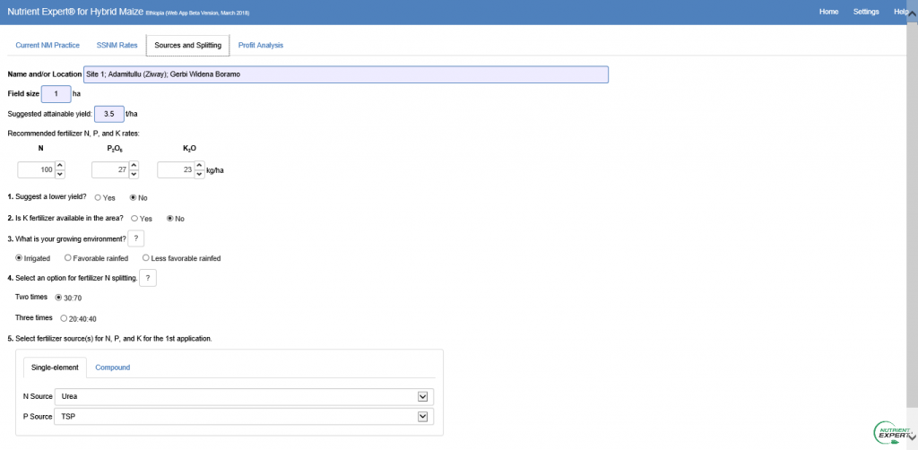
One such tool is Nutrient Expert, a free, interactive computer-based application. It can rapidly provide nutrient recommendations for individual farmers’ fields in the absence of soil-testing data. The tool was developed by the International Plant Nutrition Institute in collaboration with the International Maize and Wheat Improvement Center (CIMMYT), the International Institute of Tropical Agriculture (IITA), and research and extension service providers.

Nutrient Expert user interface.

In Ethiopia, regional fertilizer recommendations are widely used, but soil fertility management practices can vary greatly from village to village and even between individual farmers. This can make it difficult for farmers or extension agents to receive accurate information tailored specifically to their needs. Nutrient Expert fills this gap by incorporating information on available fertilizer blends and giving customized recommendations for individual fields or larger areas, using information on current farmer practices, field history and local conditions. It can also provide advice on improved crop management practices such as planting density and weeding, thereby helping farmers to maximize net returns on their investment in fertilizer.

Data calibration was based on the results of 700 multi-location nutrient omission trials conducted in major maize production areas in Ethiopia, Nigeria and Tanzania. These trials were designed as a diagnostic tool to establish which macro-nutrients are limiting maize growth and yield, and determine other possible constraints.

In Ethiopia, CIMMYT scientists working for the TAMASA project conducted nutrient omission trials on 88 farmer fields in Jimma, Bako and the Central Rift Valley in 2015 to produce a version of Nutrient Expert suitable for the country. Researchers trialed the app on six maize-belt districts in Oromia the following year, in which Nutrient Expert recommendations were compared with soil-test based and regional ones.

Researchers found that though the app recommended lower amounts of phosphorus and potassium fertilizer, overall maize yields were comparable to those in other test sites. In Ethiopia, this reduction in the use of NPK fertilizer resulted in an investment saving of roughly 80 dollars per hectare.

Results from Nutrient Expert trials in Ethiopia, Nigeria and Tanzania showed improved yields, fertilizer-use efficiency and increased profits, and the app has since been successfully adapted for use in developing fertilizer recommendations that address a wide variety of soil and climatic conditions in each of the target countries.

The World Bank’s 2016 Digital Dividends report states that we are currently “in the midst of the greatest information and communications revolution in human history.” This shifting digital landscape has significant implications for the ways in which stakeholders in the agricultural sector generate, access and use data. Amidst Africa’s burgeoning technology scene, CIMMYT’s TAMASA project demonstrates the transformative power of harnessing ICTs for agricultural development.

Learn more about different versions of Nutrient Expert and download the free software here.

TAMASA is a five-year project (2014-2019) funded by the Bill & Melinda Gates Foundation, seeking to improve productivity and profitability for small-scale maize farmers in Ethiopia, Nigeria and Tanzania. Read more about the project here.

New digital maps to support soil fertility management in Nepal

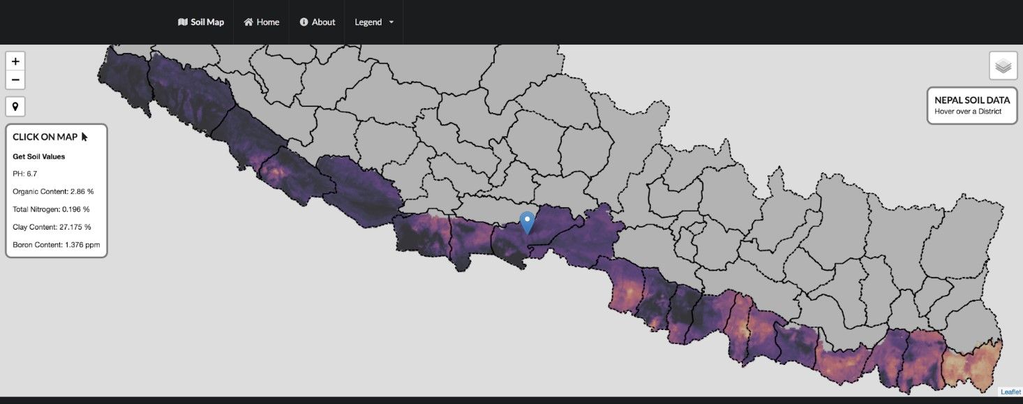
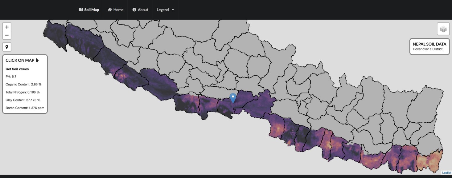
KATHMANDU, Nepal (CIMMYT) — The International Maize and Wheat Improvement Center (CIMMYT) is working with Nepal’s Soil Management Directorate and the Nepal Agricultural Research Council (NARC) to aggregate historic soil data and, for the first time in the country, produce digital soil maps. The maps include information on soil PH, organic matter, total nitrogen, clay content and boron content. Digital soil mapping gives farmers and natural resource managers easy access to location-specific information on soil properties and nutrients, so they can make efficient and localized management decisions.
As part of CIMMYT’s Nepal Seed and Fertilizer (NSAF) project, researchers used new satellite imagery that enabled the resolution of the maps to be increased from 1×1 km to 250×250 m. They have updated the web portal to make it more user friendly and interactive. When loaded onto a smartphone, the map can retrieve the soil properties information from the user’s exact location if the user is within areas with data coverage. The project team is planning to produce maps for the whole country by the end of 2019.

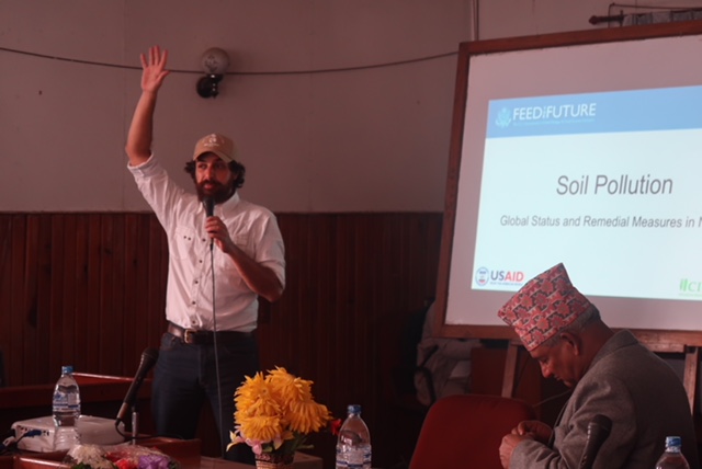
CIMMYT scientist David Guerena talks about the role of the new digital maps to combat soil fertility problems in Nepal.

At a World Soil Day event in Nepal, CIMMYT soil scientist David Guerena presented the new digital soil maps to scientists, academics, policymakers and other attendees. Guerena explained the role this tool can play in combatting soil fertility problems in Nepal.

These interactive digital maps are not simply visualizations. They house the data and analytics which can be used to inform site-specific integrated soil fertility management recommendations.

The first high-resolution digital soil maps for the Terai region have been produced with support from the data assets from the National Land Use Project, developed by Nepal’s Ministry of Agriculture and Livestock Development. These maps will be used to guide field programming of the NSAF project, drive the development of market-led fertilizer products, and inform and update soil management recommendations. The government of Nepal can use the same information to align policy with the needs of farmers and the capacity of local private seed and fertilizer companies.

In 2017, 16 scientists from Nepal’s Soil Management Directorate, NARC and other institutions attended an advanced digital soil mapping workshop where they learned how to use different geostatistical methods for creating soil maps. This year, as part of the NSAF project, four NARC scientists attended a soil spectroscopy training workshop and learned about digitizing soil data management and using advanced spectral methods to convert soil information into fertilizer recommendations.

Soil data matters

Soil properties have a significant influence on crop growth and the yield response to management inputs. For farmers, having access to soil information can make a big difference in the adoption of integrated soil fertility management.

Farmer motivation and decision-making relies heavily on the perceived likeliness of obtaining a profitable return at minimized risk. This largely depends on the yield response to management inputs, such as improved seeds and fertilizers, which depends to a large extent on site-specific soil properties and variation in agro-ecological conditions. Therefore, quantitative estimates of the yield response to inputs at a given location are essential for estimating the risks associated with these investments.

The digital soil maps can be accessed at https://nsafmap.github.io/.

The Nepal Seed and Fertilizer project is funded by the United States Agency for International Development (USAID) and is a flagship project in Nepal. The objective of the NSAF is to build competitive and synergistic seed and fertilizer systems for inclusive and sustainable growth in agricultural productivity, business development and income generation in Nepal.

New Soil Intelligence System for India provides high-quality data using modern analytics

NEW DELHI (CIMMYT) — The new Soil Intelligence System (SIS) for India will help the states of Andhra Pradesh, Bihar and Odisha rationalize the costs of generating high-quality soil data and build accessible geospatial information systems based on advanced geostatistics. The SIS initiative will rely on prediction rather than direct measurements to develop comprehensive soil information at scale. The resulting data systems will embrace FAIR access principles — findable, accessible, interoperable, and reproducible — to support better decision-making in agriculture.

SIS is a $2.5 million investment funded by the Bill & Melinda Gates Foundation. This initiative is led by the International Maize and Wheat Improvement Center (CIMMYT), in collaboration with numerous partners including the International Food Policy Research Institute (IFPRI), World Soil Information (ISRIC), the Andhra Pradesh Space Applications Center (APSAC), and the state governments and state agriculture universities of Andhra Pradesh and Bihar. The initiative runs from September 2018 through February 2021.

“SIS will make important contributions towards leveraging soil information for decision-making in Indian agriculture by devising new soil health management recommendations,” explained Andrew McDonald, CIMMYT’s Regional Team Leader for Sustainable Intensification and Project Leader for the Cereal Systems Initiative for South Asia (CSISA). Researchers and scientists will combine mapping outputs with crop response and landscape reconnaissance data through machine-learning analytics to derive precise agronomy decisions at scale.

Farmers will be the primary beneficiaries of this initiative, as they will get more reliable soil health management recommendations to increase yields and profits. SIS will also be useful to state partners, extension and agricultural development institutions, the private sector and other stakeholders who rely on high-quality soil information. Through SIS, scientists and researchers will have an opportunity to receive training in modern soil analytics.

The SIS initiative aims to facilitate multi-institutional alliances for soil health management and the application of big data analytics to real-world problems. These alliances will be instrumental for initiating broader discussions at the state and national levels about the importance of robust data systems, data integration and the types of progressive access policies related to ‘agronomy at scale’ that can bring India closer to the Sustainable Development Goals.

CIMMYT scientist Shishpal Poonia places a soil sample on the Tracer instrument for soil spectroscopy analysis.

Better soil analysis

Spectroscopy enables precise soil analysis and can help scientists identify appropriate preventive and rehabilitative soil management interventions. The technology is also significantly faster and more cost-effective than wide-scale wet chemistry-based soil analysis.

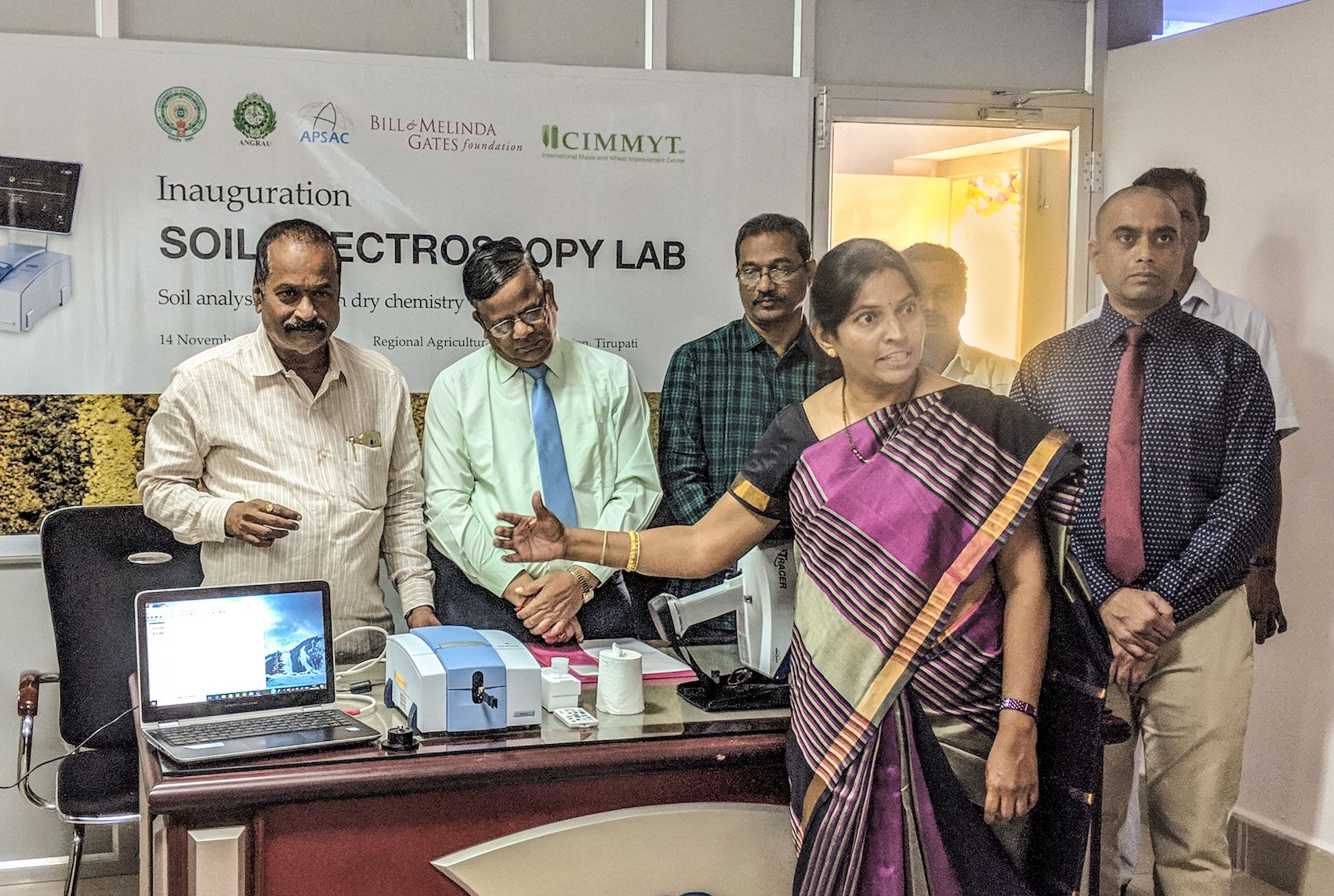
As part of the CSISA project, led by CIMMYT and funded by the Bill & Melinda Gates Foundation, two new soil spectroscopy labs were recently set up in Andhra Pradesh and Bihar, in collaboration with the state departments of agriculture. One lab is now operating at the Regional Agricultural Research Station (RARS) in Tirupati, Andhra Pradesh; and the other one at Bihar Agricultural University (BAU Sabour), in Bhagalpur, Bihar.

“The support from CIMMYT through the Gates Foundation will contribute directly to bringing down the cost of providing quality soil health data and agronomic advisory services to farmers in the long run,” said K.V. Naga Madhuri, Principal Scientist for Soil Science at Acharya N. G. Ranga Agricultural University. “We will also be able to generate precise digital soil maps for land use planning. The greatest advantage is to enable future applications like drones to use multi-spectral imagery and analyze rapidly large areas and discern changes in soil characteristics in a fast and reliable manner.”

Under the SIS initiative, soil spectroscopy results will be validated with existing gold standard wet chemistry methods. They will also be integrated with production practice data collected from the ground level, through new statistical tools.

K.V. Naga Madhuri, Principal Scientist for Soil Science at Acharya N. G. Ranga Agricultural University (front), explains soil spectra during the opening of the soil spectroscopy lab at the Regional Agricultural Research Station in Tirupati, Andhra Pradesh.

Precise predictive models

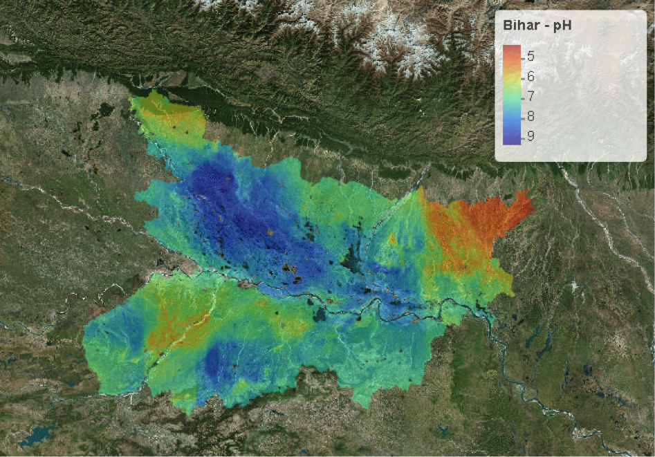
Drawing information from a limited number of soil observations from a sample dataset, digital soil mapping (DSM) uses (geo)statistical models to predict the soil type or property for locations where no samples have been taken.

“These ‘unsampled locations’ are typically arranged on a regular grid,” explained Balwinder Singh, CIMMYT scientist and Simulation Modeler, “so DSM produces gridded — raster — soil maps at a specific spatial resolution — grid cell or pixel size — with a spatial prediction made for each individual grid cell.”

“Adopting DSM methods, combined with intelligent sampling design, could reduce the strain on the soil testing system in terms of logistics, quality control and costs,” noted Amit Srivastava, a geospatial scientist at CIMMYT. “Improving digital soil mapping practices can also help create the infrastructure for a soil intelligence system that can drive decision-making at scale.”

In partnership with state government agencies and the Bill & Melinda Gates Foundation, CIMMYT will continue to support the expansion of digital soil mapping and soil analysis capacity in India. The CSISA project and the SIS initiative are helping to deliver soil fertility recommendations to farmers, an important step towards the sustainable intensification of agriculture in South Asia.

For more details, contact Balwinder Singh, Cropping System Simulation Modeler, CIMMYT at Balwinder.SINGH@cgiar.org.

An example of digital soil mapping (DSM), showing pH levels of soil in the state of Bihar. (Map: Amit Kumar Srivastava/CIMMYT)

In your seeds I trust: African seed companies test the SeedAssure application

NAIROBI (Kenya) — More than 20 representatives of eastern and southern African seed companies and regulatory agencies recently took part in the demonstration of a new seed certification application that can help get quality seed to market more quickly and curb sales of counterfeit seed.

As part of an event organized by the International Maize and Wheat Improvement Program (CIMMYT) at the Kiboko research station of the Kenya Agricultural & Livestock Research Organization (KALRO) on September 17, 2018, participants field-tested a beta version of SeedAssure, a digital platform that gives automatic feedback on compliance and seed production management, along with remedy options.

SeedAssure was developed by Cellsoft, a supply chain management software company, with input from the Alliance for a Green Revolution in Africa (AGRA), the Qualibasic Seed Company, the Kenya Plant Health Inspectorate Service (KEPHIS) and CIMMYT.

“This is very useful for companies like ours, spread as we are over different countries, to manage at a distance our seed growers,” said Andy Watt of QualiBasic Seed Company, who has been testing SeedAssure on the company’s farms. “The application’s dashboard will point out which farms to visit quickly for corrections.”

Mobile innovations enhance quality and speed

For over a decade, the region’s seed sector has sought fast, cost-effective and transparent seed quality control and certification approaches for use across the value chain and the region. Seed companies often rely on under-staffed national certification agencies that may miss critical inspections or give inaccurate reports. Registration of new varieties can take many years, discouraging investment in improved seed and impeding regional trade.

Worse, by some estimates as much as 40 percent of the seed sold in eastern and southern Africa is falsely labelled or not what farmers are told they are buying. KEPHIS recently confiscated over 13 tons of “fake” seeds.

The seed sector has sought mobile innovations such as tablet-based field inspections whose data load to centralized, cloud-based dashboards.

With SeedAssure’s “traffic light” system, field inspection results for factors such as plant population will score green (complied – good quality), amber (needs improvement) or red (reject) and be readily visible to key actors in the seed certification and supply chain, according to David Laurence-Brown, SeedAssure co-developer.

“This quality assurance system can help seed companies get licenses faster, speeding product to market and greatly reducing the financial risk of getting new varieties to farmers,” said Laurence-Brown. “The vision is that all actors have access to timely and accurate data on products, licensing and trade movements, with quality control checks along the value chain.”

He said that SeedAssure features 260 critical questions in 13 seed production checklists. “Putting the right questions in the right order is crucial to determine how sustainable your seed production is,” Laurence-Brown explained.

Partners test the SeedAssure app on a tablet during a field visit in Kiboko, Kenya. (Photo: Jerome Bossuet/CIMMYT)

Fixing the bugs

Participants emphasized that national and regional regulatory bodies needed to be on board.

“Advocacy has to be done at different levels, from COMESA, national plant protection organizations, big and small seed companies, and research institutes and donors,” said Kinyua Mbijjewe, a well-known figure in the African seed industry and co-creator of SeedAssure, adding that this has been underway for a year now with a positive response, and public engagement is now ramping up with partners like AGRA and USAID.

Participants also suggested simplifying SeedAssure by reducing the number of questions and the subjectivity of certain data fields. For example, they observed that a more objective method was needed for scoring pest infestations, rather than SeedAssure’s current approach of rating infestations as low, moderate or intense via visual estimation.

“This will not be adopted if it’s too complex,” said Nicolai Rodeyns, NASECO seed company, Uganda.

Developers are addressing these issues, as well as comments that the application should not mix compliance and seed production management features.

CIMMYT announced that it would offer members of the International Maize Improvement Consortium (IMIC) a one-year trial subscription to SeedAssure.

Finally, AFSTA, AGRA, CIMMYT, COMESA, USAID, and other partners are forming a SeedAssure Alliance to support testing and rollout with companies and public organizations in eastern and southern Africa.

Are advisory apps a solution for collecting Big Data?

Big Data is transforming the way scientists conduct agricultural research and helping smallholder farmers receive useful information in real time. Experts and partners of the CGIAR Platform for Big Data in Agriculture are meeting on October 3-5, 2018, in Nairobi, Kenya, to share their views on how to harness this data revolution for greater food and nutrition security.

Jordan Chamberlin, Spatial Economist at CIMMYT, will give his insights on best practices on electronic data capture on October 4, 2018.

NAIROBI (Kenya) — Agronomic researchers face several challenges and limitations related to data. To provide accurate predictions and useful advice to smallholder farmers, scientists need to collect many types of on-farm data; for example, field size, area devoted to each crop, inputs used, agronomic practices followed, incidence of pests and diseases, and yield.

These pieces of data are expensive to obtain by traditional survey methods, such as sending out enumerators to ask farmers a long list of questions. Available data is often restricted to a particular geographical area and may not capture key factors of production variability, like local soil characteristics, fertilizer timing or crop rotations.

As a result, such datasets cannot deliver yield predictions at scale, one of the main expectations of Big Data. Digital advisory apps may be part of the solution, as they use crowdsourcing to routinize data collection on key agronomic variables.

The Taking Maize Agronomy to Scale in Africa (TAMASA) project has been researching the use of mobile apps to provide site-specific agronomic advice to farmers through agro-dealers, extension workers and other service providers.

At CIMMYT, one of the research questions we were interested in was “Why are plant population densities in farmers fields usually well below recommended rates?” From surveys and yield estimates based on crop-cut samples at harvest in Ethiopia, Nigeria and Tanzania, we observed that yields were correlated with plant density.

What was making some farmers not use enough seeds for their fields? One possible reason could be that farmers may not know the size of their maize field. In other cases, farmers and agro-dealers may not know how many seeds are in one packet, as companies rarely indicate it and the weight of each seed variety is different. Or perhaps farmers may not know what plant population density is best to use. Seed packets sometimes suggest a sowing rate but this advice is rather generic and assumes that farmers apply recommended fertilizer rates. However, farmers’ field conditions differ, as does their capacity to invest in expensive fertilizers.

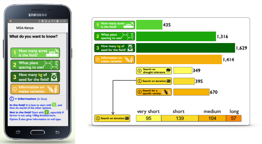
To help farmers overcome these challenges, we developed a simple app, Maize-Seed-Area. It enables farmers, agro-dealers and extension workers to measure the size of a maize field and to identify its key characteristics. Then, using that data, the app can generate advice on plant spacing and density, calculate how much seed to buy, and provide information on seed varieties available at markets nearby.

View of the interface of the Maize-Seed-Area app on mobile phones and tablets. (Photo: CIMMYT)

Maize-Seed-Area is developed using the Open Data Kit (ODK) format, which allows to collect data offline and to submit it when internet connection becomes available. In this case, the app is also used to deliver information to the end users.

Advisory apps usually require some input data from farmers, so advice can be tailored to their particular circumstances. For example, they might need to provide data on the slope of their field, previous crops or fertilizer use. Some additional information may be collected through the app, such as previous seed variety use. All this data entered by the user, which should be kept to a minimum, is routinely captured by the app and retrieved later.

Hello, Big Data!

As the app user community grows, datasets on farmer practices and outcomes grow as well. In this case, we can observe trends in real time, for instance on the popularity of different maize varieties.

In a pilot in western Kenya, in collaboration with Precision Agriculture for Development (PAD), some 100 agro-dealers and extension workers used the app to give advice to about 2,900 farmers. Most of the advice was on the amount of seed to buy for a given area and on the characteristics of different varieties.

Data showed that the previous year farmers grew a wide range of varieties, but that three of them were dominant: DK8031, Duma43 and WH505.

Preferred variety of maize for sample farmers in western Kenya (Bungoma, Busia, Kakamega and Siaya counties), February-March 2018.

A phone survey among some 300 of the farmers who received advice found that most of them anticipated to do things differently in the future, ranging from asking for advice again (37 percent), growing a different maize variety (31 percent), buying a different quantity of seed (19 percent), using different plant spacing (18 percent) or using more fertilizer (16 percent).

Most of the agro-dealers and extension workers have kept the app for future use.

The dataset was collected in a short period of time, just two months, and was available as soon as app users got online.

The Maize-Seed-Area pilot shows that advisory apps, when used widely, are a major source of new Big Data on agronomic practices and farmer preferences. They also help to make data collection easier and cheaper.

TAMASA is supported by the Bill and Melinda Gates Foundation and is implemented by the International Maize and Wheat Improvement Center (CIMMYT), the International Institute of Tropical Agriculture (IITA), the International Plant Nutrition Institute (IPNI) and Africa Soil Information Service (AfSIS).

Breaking Ground: Francelino Rodrigues on high-tech farming

EL BATAN, Mexico (CIMMYT) — When Francelino Rodrigues started at the International Maize and Wheat Improvement Center (CIMMYT) in 2013, the majority of the maize and wheat trials were still being carried out by walking through the field and taking measurements manually.


Through a collaborative work initiative with colleagues from maize and wheat breeding programs, and with support from senior scientists, Rodrigues brought a whole new world of digital mapping and proximal high-resolution soil sensing to the center’s trials thanks to his background in precision agriculture.

Precision agriculture makes use of technologies and farmers’ knowledge to determine the quantity, location and time resources need to be applied to grow crops. The information gained allows farmers to farm more sustainably; using less while maintaining and improving yields.

“I first discovered precision agriculture during an agricultural engineering undergraduate in Brazil,” explained Rodrigues. “I was fascinated by the idea of joining technology and agriculture, so I ended up going on to complete a master’s and a doctorate in precision agriculture applying it to coffee, sugarcane, and cereals crops.”

After completing his doctorate with an internship at the Commonwealth Scientific and Industrial Research Organization (CSIRO), an Australian government agency for scientific research, Rodrigues realized the importance of agricultural research for development and took on his post-doctoral position at CIMMYT within the biometrics team in remote sensing and precision agriculture.

“Remote sensing can provide information at different scales and for a range of applications, from crop management to high-throughput phenotyping and landscape assessment,” said Rodrigues, whose research focuses on the analysis and interpretation of spatial and temporal agricultural data sets built up by the use of proximal and remote sensing technologies, then seeing how it can be applied across CIMMYT’s work.

Preparing for radiometric calibration for Multispectral flight over maize Tar Spot Complex disease screening; CIMMYT’s station, Agua Fria, Mexico. April 2016 Photo: CIMMYT archives.
Preparing for radiometric calibration for a multispectral flight over maize Tar Spot Complex disease screening; CIMMYT’s station, Agua Fria, Mexico. Photo: CIMMYT archives.

Remote sensing devices make it possible to observe the dynamics from single plants up to entire landscapes and continents as they change over time by capturing radiation from across the electromagnetic spectrum.

“Precision agriculture and remote sensing technologies are used by CIMMYT to develop tools and practices to help farmers manage their crops more efficiently, to speed up the breeding process by rapidly assessing plant traits and to better characterize agricultural landscapes as a  whole,” he said.

According to Rodrigues, one of the greatest challenges is making precision agriculture accessible to smallholder farmers who don’t have the means to access new and expensive technology.  He is currently working on a public-private project using remote sensing data assimilation and crop modeling to build an online platform that farmers can use freely in their fields to make crop management decisions.

“Since I arrived at CIMMYT I have been exposed to a global network of world-class scientists,” said Rodrigues. “It encourages me to pursue my passions and allowed me to do what I love; good science that improves lives.”

Rodrigues is excited about the long-term impact of CIMMYT’s research and positive about the future. “I love to work with a team of scientists from different disciplines and see that knowledge and results we generate contribute to a wider agenda,” he said.

Breaking Ground: Mainassara Zaman-Allah uses remote sensing to expedite phenotyping

TwitterBGMZMEXICO CITY (CIMMYT) – Remote sensing technology is on track to make crop breeding faster and more efficient, ensuring smallholder farmers get the improved maize varieties they need.

Field phenotyping – the comprehensive physical assessment of plants for desired traits – is an integral part of the crop breeding process but can create a costly and time-consuming bottleneck, according to Mainassara Zaman-Allah, abiotic stress phenotyping specialist at the International Maize and Wheat Improvement Center (CIMMYT).

Now, technological advances such as proximal or aerial sensing allow scientists to quickly collect information from plants to develop improved varieties.

“Previously, we used to measure maize height with a stick, and manually capture the data” he said. “Now we use proximal sensing—a laser distance meter connected to your phone or tablet that automatically captures data —to measure plant height 2 to 3 times faster for half of the labor. We also use digital ear imaging to analyze maize ear and kernel attributes including grain yields  without having to shell the cobs, saving time and money on labor. This will be helpful particularly to most of our partners who do not own the machinery required for shelling after harvest”

Zaman-Allah also works with aerial sensing, using unmanned aerial vehicles equipped with sensors to fly over crop fields and collect images that are later processed to extract crop phenotypic data. “Aerial phenotyping platforms enable us to collect data from 1,000 plots in 10 minutes or less, a task that might take eight hours to do manually,” he said.

This means that developing improved maize varieties with tolerance to heat and drought, as well as devastating diseases such as maize lethal necrosis (MLN), could become faster and more cost-effective than ever before. Application of aerial and proximal sensing technology for high-throughput phenotyping, in which large amounts of data are processed simultaneously, provides high-resolution measurements for research plots that can enable the rapid identification of stress tolerant varieties, speeding up the breeding process.

The time and money saved by using these technologies allow researchers to develop and deploy improved varieties more quickly to the smallholder farmers that need them most, which is especially important as climate change begins to change growing environments faster than traditional varieties can adapt.

For Zaman-Allah, this interest in improving agriculture for all is “in the blood,” he said. While growing up in Niger, his family had to move to a different city every three years due to his father’s job. “Everywhere we moved; my father made sure that we rented or bought a small farm, where I would be involved in crop production every year during the long vacations over the rainy season. That was a wonderful experience as I learned a lot regarding crop production, drought and soil fertility management.”

He would take this first-hand experience in agriculture to the next level while earning undergraduate and postgraduate degrees at the University of Carthage in Tunisia and conducting research for his Ph.D. in plant eco-physiology at the French National Institute for Agricultural Research (INRA) through a grant from the French Agency for International Cooperation.

Zaman-Allah joined CIMMYT in late 2012 as a scientist with a specialization in heat and stress resilient maize, based in Harare, Zimbabwe. He has been working as an abiotic stress phenotyping specialist since late 2015, and is considered a pioneer in remote sensing work in CIMMYT maize breeding. In addition to his work as a scientist, he also writes codes for the programs used in proximal sensing.

“As part of my current job, I develop, test and validate low-cost and high-throughput field-based phenotyping tools and methods for different desired traits in crops, including drought, heat and low-nitrogen stress,” he said.

“My team is working to provide opportunities toward next-generation phenotyping that is more compatible with maize breeders needs and that will significantly minimize selection cost while maximizing selection efficiency, accelerating the process to deliver maize varieties with better genetic traits to farmers.”

Zaman-Allah’s commitment to food security extends beyond his job. On his own time, he shares knowledge gained at CIMMYT to inform his contacts at universities and national agricultural research centers in Niger and help increase his home country’s capacity to produce healthy crops.

“Maize and wheat are not usually grown in Niger due to heat, drought and low soil fertility, but due to recent advances in CIMMYT technologies and improved varieties, they are now a possibility,” he said. “People were doubtful at first, but when improved varieties from CIMMYT Mexico and CIMMYT-Zimbabwe were planted side by side with locally released varieties, there was no comparison—the CIMMYT varieties performed far better.”

Working at CIMMYT has given Zaman-Allah a unique opportunity to help farmers while also working with a top-notch international team.

“I really enjoy the teamwork, the innovation and the challenge to make a difference,” he said. “It’s immensely satisfying to be able to contribute in helping smallholder farmers through my work. Whenever I take vacation, I always go back to the village in Niger where my family is from, and I love to talk with local farmers about the latest agricultural technologies that could help them.”

Breaking Ground: Crop simulation models help Balwinder Singh predict future challenges

TwitterBGBalwinder3Breaking Ground is a regular series featuring staff at CIMMYT

EL BATAN, Mexico (CIMMYT) – Balwinder Singh uses crop simulation models to help smallholder farmers in South Asia prepare for future climates and unexpected challenges.

Despite improvements in agricultural technology in the past few decades, crop yield gaps persist globally. As climate patterns change, farmers are at risk of crop loss and reduced yields due to unforeseen weather events such as drought, heat or extreme rains.

Singh, a cropping system simulation modeler at the International Maize and Wheat Improvement Center (CIMMYT) based in New Delhi, India, uses crop simulation models—software that can estimate crop yield as a function of weather conditions, soil conditions, and choice of crop management practices—to develop future climate predictions that can help farmers reduce risk, overcome labor and resource constraints, intensify productivity and boost profitability.

“Using future climate data, simulation modelling allows researchers to develop hypotheses about future agricultural systems,” said Singh. “This can help predict and proactively mitigate potentially catastrophic scenarios from challenges such as shrinking natural resources, climate change and the increasing cost of agricultural production.”

A specific focus is on how to best quantify, map and diagnose the causes of the gap between potential yields and actual yields achieved by cereal farmers in the Indo-Gangetic Plain. “My research combines field experimentation, participatory engagement, and cropping systems modelling and spatial data to identify promising technologies for increasing crop productivity and appropriate geographical areas for out scaling,” he said.

For example, Singh and a team of scientists have used simulation tools to find out why wheat productivity is low in the Eastern Gangetic Plains, for example, late sowing, suboptimal crop mangement and terminal heat stress. This process identified various potential techniques to raise wheat productivity, such as early sowing, zero tillage, or short duration rice varieties to facilitate early harvest and field vacation. Geospatial data and tools were used to identify the potential target zones for deployment of these promising technologies.

“The research is helping farmers increase agricultural productivity and to manage climate-related crop production risk and increase the use of agricultural decision support systems,” Singh said. “My research towards improving cereal production systems in South Asia contributes to the knowledge, process understanding and modelling tools needed to underpin recommendations for more productive and sustainable production systems.”

Growing up in rural India in a farming family, Singh viewed firsthand the uncertainty that smallholder farmers can face.

“I was brought up and studied in northwestern India – the region where the green revolution occurred known as the food basket of India,” Singh said.

“I grew up playing in wheat and cotton fields, watching the sowing, growing and harvesting of crops, so an interest in agricultural science came naturally to me and I have never regretted choosing agriculture as a career.”

While studying for his bachelor’s and master’s degrees in agronomy at Punjab Agricultural University (PAU) in Ludhiana, India, a chance encounter helped shape his career.

“Dr. Norman Borlaug came to PAU in 2005 and he happened to visit my field experiment on bed planting wheat. I had a very inspiring conversation with him which made me decide to pursue a career in agricultural research and work for the farming community.”

Singh went on to earn a Ph.D. from Charles Sturt University in Australia through the John Allwright Fellowship funded by the Australian Center for International Agriculture Research (ACIAR). He started work for CIMMYT in 2013 as associate scientist based in New Delhi working with the Cereal Systems Initiative for South Asia (CSISA) project, which aims to improve food security and the livelihoods of more than 8 million farmers in South Asia by 2020.

Since 2014, Singh has led the CIMMYT participation in the  Agricultural Model Intercomparison and Improvement Project (AgMIP) as part of the Indo-Gangetic Basin team, conducting integrated assessments of the effects of climate change on global and regional food production and security, analyzing adaptation and mitigation measures.

Apart from collaborating with CIMMYT colleagues and other advanced research institutes from across the world to build weather and soil databases or working on simulation models, Singh enjoys interacting with farmers in their own fields and collecting data for crop simulation models to generate useable information for research and extension.

He also holds training sessions to aid in developing the capacity of CIMMYT’s national agricultural partners in system simulation modelling to create awareness of the proper use of simulation tools for research and extension.

“The most rewarding aspect of my work is to see my simulation results working in farmers’ fields,” Singh said. “There’s a proverb that says: ‘When a person is full they have a thousand wishes, but a hungry person has only one.’ There is no nobler task than that of being able to feed people. Some of us are not even aware of how many people are starving every day,” he said.

“It gives me great satisfaction to be a part of CIMMYT, an organization that works beyond political boundaries to safeguard future food security, improve livelihoods and carry on the legacy of Dr. Borlaug who fed billions.”

Cutting-edge tools promote conservation, use of biodiversity

The CIMMYT maize germplasm bank holds 28,000 samples of unique maize genetic diversity that could hold the key to develop new varieties farmers need. Photo: Xochiquetzal Fonseca/CIMMYT.

EL BATAN, Mexico (CIMMYT) – Biodiversity is the building block of health for all species and ecosystems, and the foundation of our food system. A lack of genetic diversity within any given species can increase its susceptibility to stress factors such as diseases, pests, heat or drought for lack of the genetic variation to respond. This can lead to devastating consequences that include crop failures and extinction of species and plant varieties. Conserving and utilizing biodiversity is crucial to ensure the food security, health and livelihoods of future generations.

The 13th meeting of the Conference of the Parties (COP 13) to the Convention on Biological Diversity will be held in Cancún, Mexico, from December 5 to 17, 2016. Established in 1993 due to global concerns over threats to biodiversity and species extinctions, the Convention on Biological Diversity is an international, legally-binding treaty with three main objectives: the conservation of biological diversity; the sustainable use of the components of biological diversity; and the fair and equitable sharing of the benefits arising out of the utilization of genetic resources.

Mexico’s Secretariat of Agriculture (SAGARPA) has invited scientists from the International Maize and Wheat Improvement Center (CIMMYT) working with the MasAgro Biodiversidad (known in English as Seeds of Discovery, or SeeD) initiative to present at COP 13 on their work to facilitate the use of maize genetic diversity, particularly through a collection of tools and resources known as the “Maize Molecular Atlas.” The presentations will focus on how resources that have been developed can aid in the understanding of germplasm stored in genebanks and collections to enable better use.

As the region of origin and as a center of diversity for maize, Mexico and Mesoamerica are home to much of the crop’s genetic variation. Thousands of samples of maize from this and other important regions are preserved in the CIMMYT germplasm bank, in trust, for the benefit of humanity. The bank’s 28,000 maize seed samples hold diversity to develop new varieties for farmers to respond to challenges such as heat, disease and drought stress. However, information on the genetic makeup and physical traits of these varieties is often limited, making the identification of the most relevant samples difficult.

Native maize varieties, known as landraces, contain a broad amount of genetic diversity that could protect food security for future generations.

SeeD works to better characterize and utilize novel genetic diversity in germplasm banks to accelerate the development of new maize and wheat varieties for the benefit of farmers. The initiative has generated massive amounts of information on the genetic diversity of maize and wheat, as well as cutting-edge software tools to aid in its use and visualization. This information and tools are freely available as global public goods for breeders, researchers, germplasm bank managers, extension agents and others, but are even more powerful when they are integrated with different types and sets of data.

Developed by the SeeD initiative, the maize molecular atlas represents an unparalleled resource for those interested in maize genetic diversity.

“You can think of the maize molecular atlas like a satellite navigation system in your car,” said Sarah Hearne, a CIMMYT scientist who leads the project’s maize component. “Information that used to be housed separately, such as maps, traffic or the locations of police officers, gas stations, restaurants and hotels, are now brought together. It’s the same with the atlas. Having access to all of these data at once in an interlinked manner allows people to make better decisions, faster,” she said.

SeeD’s maize molecular atlas includes three main types of resources: data, such as maize landrace passport data (where it came from, when it was collected, etc.), geographic information system (GIS) -derived data (what the environment was like where maize was collected; rainfall, soils, etc.), genotypic data (genetic fingerprints of maize varieties) and available phenotypic data (information on how plants grow in different conditions); knowledge, (derived from data-marker trait associations; what bits of the genome do what); and tools, including data collection software (KDSmart), data storage and query tools (Germinate) and visualization tools (CurlyWhirly).

All of these resources are available through the SeeD website, where, when used together, they can increase the effective and efficient identification and utilization of maize genetic resources.

Interestingly, one of the first benefits of this initiative was for Mexican farmers. The efforts to better characterize the collection led to the identification of landraces that were resistant to Tar Spot, a disease that is devastating many farmers’ fields in Mexico and Central America. These landraces were immediately shared with farming communities while also being utilized in breeding programs. Smallholders in particular grow crops in diverse environmental conditions. They need diverse varieties. The understanding and use of biodiversity by researchers, breeders and farmers will be crucial to ensure the use of more and genetically diverse crops.

“With the atlas we now have the ability, with fewer resources, to interlink and query across different data types in one searchable resource,” Hearne said. This will allow breeders and researchers world-wide to hone in on the genetic and physical plant traits they are looking for, to more quickly identify and use novel genetic diversity to create improved varieties adapted to their specific needs. So far about 250 researchers and students from Mexico have participated in workshops and activities to begin using the new tools. With Mexico being a very important center of diversity for many species, agricultural and beyond, the same tools could be used for other species, here and abroad.

Hearne is looking forward to sharing information about MasAgro Biodiversidad and CIMMYT’s progress at COP 13, and is hopeful about the impacts the maize molecular atlas will have on biodiversity conservation.

“Conservation isn’t just preservation, it’s use. The molecular maize atlas enables us to better utilize the genetic resources we have, but also to better understand what diversity we may still need for our collection,” she said. “If you don’t know what you have, you don’t know what you need to preserve or look for. The work of the maize molecular atlas helps to address the underlying causes of biodiversity loss by raising awareness of the importance of these resources for sustainable food production while enabling researchers world-wide to use the information for assessing their own collections and generate more diverse varieties.”

SeeD is a multi-project initiative comprising: MasAgro Biodiversidad, a joint initiative of CIMMYT and the Mexican Ministry of Agriculture (SAGARPA) through the MasAgro (Sustainable Modernization of Traditional Agriculture) project; the CGIAR Research Programs on Maize (MAIZE CRP) and Wheat (WHEAT CRP); and a computation infrastructure and data analysis project supported by the UK’s Biotechnology and Biological Sciences Research Council (BBSRC). Learn more about the Seeds of Discovery project here

CIMMYT-led climate project is finalist at Asia Mobile Tech Awards

By Katie Lutz 

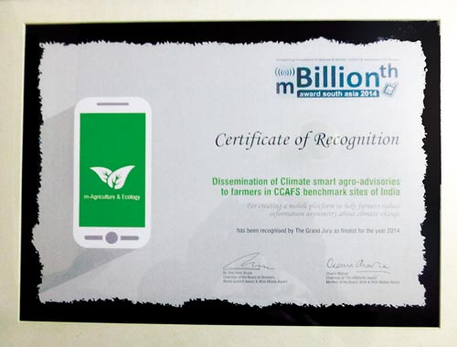
A CIMMYT-led project was named as a finalist for the 2014 mBillionth Award South Asia thanks to its mobile platform that helps farmers adapt to changing climate conditions.

“Dissemination of climate-smart agro-advisories to farmers in CCAFS benchmark sites of India” was launched in August 2013 under the leadership of Dr. Surabhi Mittal, a senior agricultural economist based in India, in cooperation with the CGIAR Research Program on Climate Change, Agriculture and Food Security (CCAFS). In the past 10 months, the project has helped 1,200 male and female farmers in eight Indian villages to gain more knowledge about climate-smart technology and adopt technologies to lessen their risks from climate fluctuations. The project also measured how receiving information on mobile telephones will affect farmers.

More than 300 entries were submitted for the award, which honors the most influential and leading practices in the mobile and telecommunications industry in South Asia. It was presented 18 July by the Digital Empowerment Foundation and Vodafone in a ceremony at the India Habitat Center. The CIMMYT project received acknowledgment for its impact on small farmers from Sanjeev Gupta, joint secretary of the Indian Ministry of Agriculture, and M.V. Ashok, chief general manager of the National Bank for Agriculture and Rural Development.

CIMMYT’S director general, Dr. Thomas A. Lumpkin, congratulated everyone involved with the project. “This shows your technological leadership,” he said in a staff email announcing the award. “Use this to energize your activities.”

New technologies help Indian farmers improve nutrient management

By ML Jat, RS Dadarwal, Tripti Agarwal and Love Kumar Singh/CIMMYT

In the intensively cropped region of northwest India, farmers generally use imbalanced and inappropriate nutrient doses, which leads to low yields, high production costs and low nutrient efficiency. The resulting loss of applied nutrients, particularly nitrogen, creates a large environmental footprint.

Photo: Vikas Choudhary

An interactive workshop was held 5-6 June in Haryana State to promote the use of precision nutrient management tools in smallholder production systems. The 175 participants received hands-on training in Nutrient ExpertTM, a software tool that helps determine fertilizer requirements in cereals, and GreenSeekerTM, an optical sensor that measures the Normalized Difference Vegetation Index, an indicator of crop development and health.

To encourage widespread adoption of both technologies, the agriculture departments in the participating districts received them for free. Meanwhile, Haryana’s Department of Agriculture has planned more than 1,000 demonstrations of the tools in maize and rice fields during this year’s rainy season.

The training was jointly organized by the International Plant Nutrition Institute-South Asia Program, CIMMYT and the Haryana Department of Agriculture, under the umbrella of the CGIAR Research Program on Climate Change, Agriculture and Food Security (CCAFS). Many of the participants were agriculture development officers or extension experts who will use the tools to devise climate-smart management strategies for sustainable development.

Nutrient management tool wins award

A tool developed by CIMMYT and the International Plant Nutrition Institute (IPNI) offering site-specific nutrient management (SSNM) advice to help farmers achieve higher yields more efficiently recently won an innovation award.

Nutrient ExpertTM decision support tools received the best innovation award in the information and communications technology category at the Bihar Innovation Forum II, which recognizes innovations to improve rural livelihoods in India. These tools were in development by CIMMYT and IPNI for five years and were launched in June 2013.

In South Asia, 90 percent of smallholder farmers do not have access to soil testing. The computer-based support tools aim to provide them with simple advice on how to get the most from fertilizer inputs. An IPNI study funded by the CGIAR Research Program on Maize (MAIZE CRP) Competitive Grant Initiative (CGI) found that farming practices and the resources available to farmers vary hugely in east India.

The cutting-edge value of Nutrient ExpertTM is that it offers specific information at the farm level, where it can provide the greatest benefits. Nutrient ExpertTM is especially relevant because it was developed through dialogue and participation with stakeholders, which also raises awareness and eventual adoption by users.

It is now used by the Indian National Agricultural Research System and is a key intervention used by the CRP on Climate Change, Agriculture and Food Security (CCAFS) in its Climate Smart Villages. The Nutrient ExpertTM approach is also being applied to maize and wheat in other areas of Southeast Asia, China, Kenya and Zimbabwe.