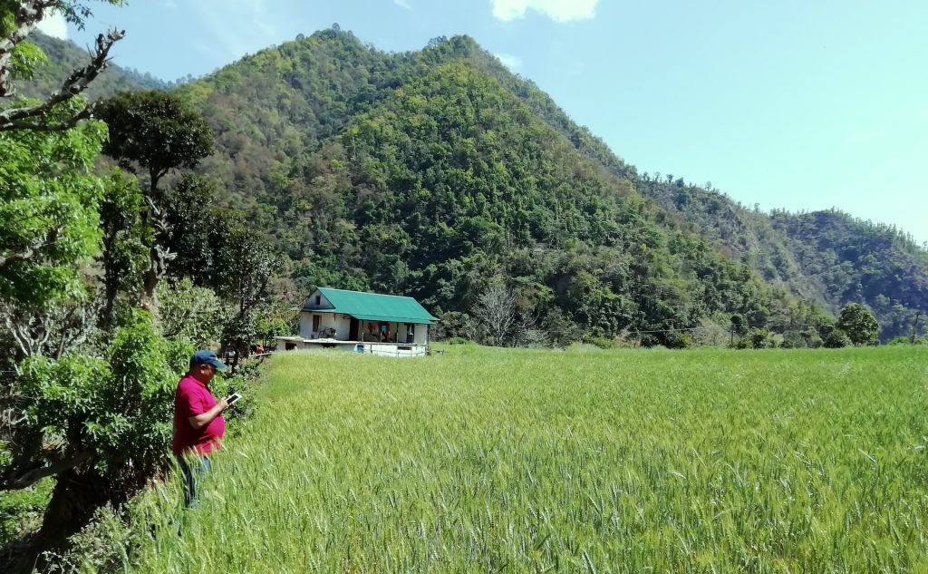
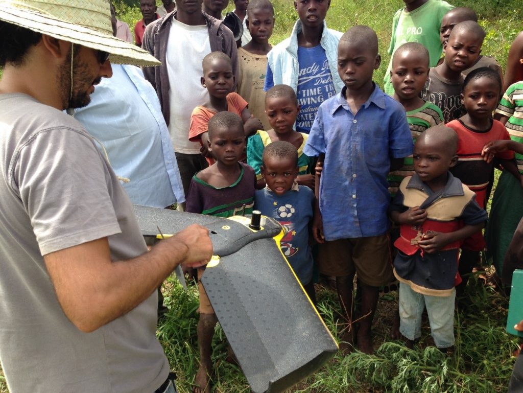
funder_partner: UK Space Agency

A view from above

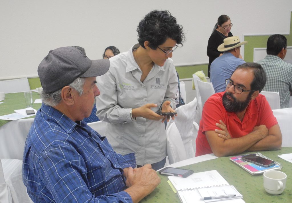
Scientists at the International Maize and Wheat Improvement Center (CIMMYT) have been harnessing the power of drones and other remote sensing tools to accelerate crop improvement, monitor harmful crop pests and diseases, and automate the detection of land boundaries for farmers.

A crucial step in crop improvement is phenotyping, which traditionally involves breeders walking through plots and visually assessing each plant for desired traits. However, ground-based measurements can be time-consuming and labor-intensive.

This is where remote sensing comes in. By analyzing imagery taken using tools like drones, scientists can quickly and accurately assess small crop plots from large trials, making crop improvement more scalable and cost-effective. These plant traits assessed at plot trials can also be scaled out to farmers’ fields using satellite imagery data and integrated into decision support systems for scientists, farmers and decision-makers.

Here are some of the latest developments from our team of remote sensing experts.

An aerial view of the Global Wheat Program experimental station in Ciudad Obregón, Sonora, Mexico (Photo: Francisco Pinto/CIMMYT)

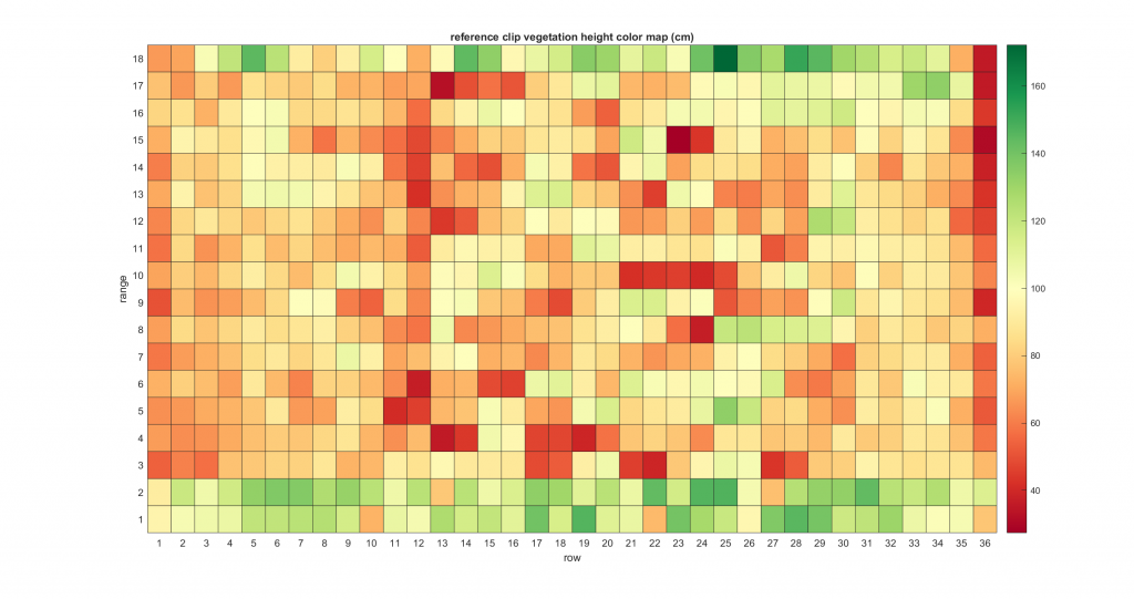
Measuring plant height with high-powered drones

A recent study, published in Frontiers in Plant Science validated the use of drones to estimate the plant height of wheat crops at different growth stages.

The research team, which included scientists from CIMMYT, the Federal University of Viçosa and KWS Momont Recherche, measured and compared wheat crops at four growth stages using ground-based measurements and drone-based estimates.

The team found that plant height estimates from drones were similar in accuracy to measurements made from the ground. They also found that by using drones with real-time kinematic (RTK) systems onboard, users could eliminate the need for ground control points, increasing the drones’ mapping capability.

Recent work on maize has shown that drone-based plant height assessment is also accurate enough to be used in maize improvement and results are expected to be published next year.

A map shows drone-based plant height estimates from a maize line trial in Muzarabani, Zimbabwe. (Graphic: CIMMYT)

Advancing assessment of pests and diseases

CIMMYT scientists and their research partners have advanced the assessment of Tar Spot Complex — a major maize disease found in Central and South America — and Maize Streak Virus (MSV) disease, found in sub-Saharan Africa, using drone-based imaging approach. By analyzing drone imagery, scientists can make more objective disease severity assessments and accelerate the development of improved, disease-resistant maize varieties. Digital imaging has also shown great potential for evaluating damage to maize cobs by fall armyworm.

Scientists have had similar success with other common foliar wheat diseases, Septoria and Spot Blotch with remote sensing experiments undertaken at experimental stations across Mexico. The results of these experiments will be published later this year. Meanwhile, in collaboration with the Federal University of Technology, based in Parana, Brazil, CIMMYT scientists have been testing deep learning algorithms — computer algorithms that adjust to, or “learn” from new data and perform better over time — to automate the assessment of leaf disease severity. While still in the experimental stages, the technology is showing promising results so far.

CIMMYT researcher Gerald Blasch and EIAR research partners Tamrat Negash, Girma Mamo and Tadesse Anberbir (right to left) conduct field work in Ethiopia. (Photo: Tadesse Anberbir)

Improving forecasts for crop disease early warning systems

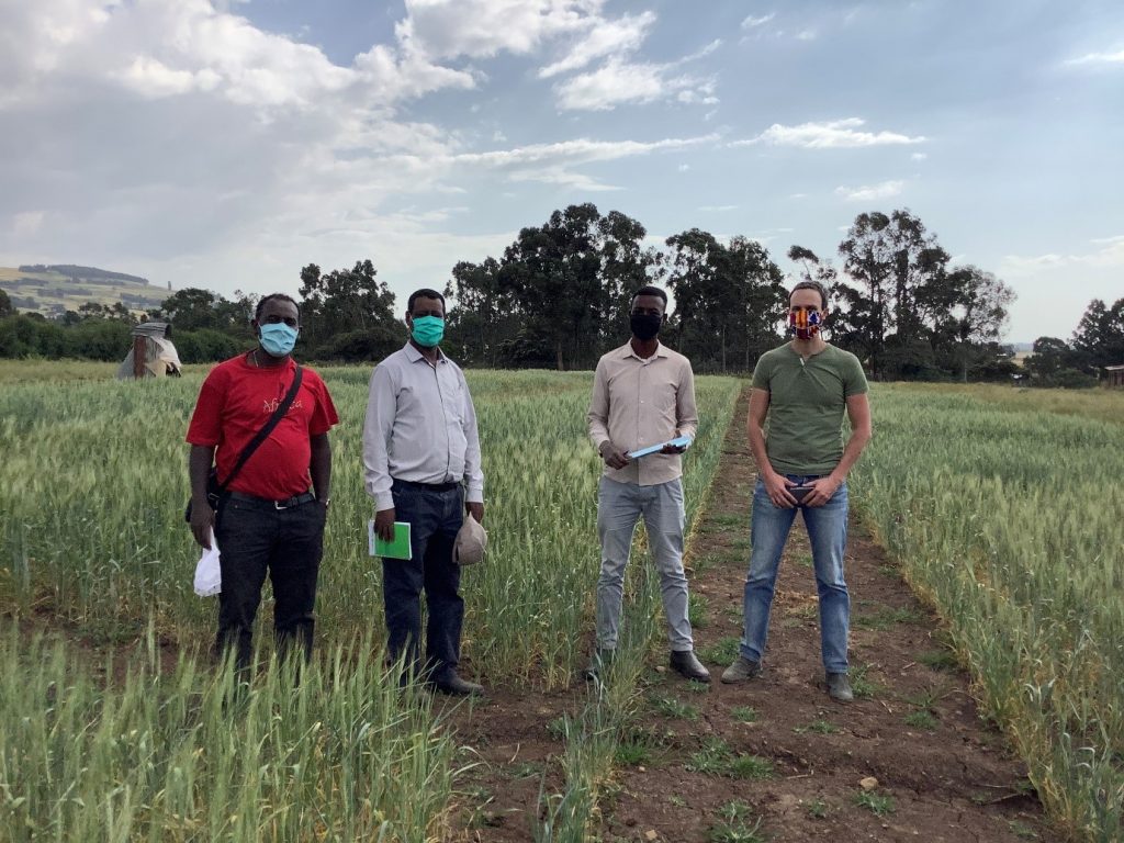
CIMMYT scientists, in collaboration with Université catholique de Louvain (UCLouvain), Cambridge University and the Ethiopian Institute of Agricultural Research (EIAR), are currently exploring remote sensing solutions to improve forecast models used in early warning systems for wheat rusts. Wheat rusts are fungal diseases that can destroy healthy wheat plants in just a few weeks, causing devastating losses to farmers.

Early detection is crucial to combatting disease epidemics and CIMMYT researchers and partners have been working to develop a world-leading wheat rust forecasting service for a national early warning system in Ethiopia. The forecasting service predicts the potential occurrence of the airborne disease and the environmental suitability for the disease, however the susceptibility of the host plant to the disease is currently not provided.

CIMMYT remote sensing experts are now testing the use of drones and high-resolution satellite imagery to detect wheat rusts and monitor the progression of the disease in both controlled field trial experiments and in farmers’ fields. The researchers have collaborated with the expert remote sensing lab at UCLouvain, Belgium, to explore the capability of using European Space Agency satellite data for mapping crop type distributions in Ethiopia. The results will be also published later this year.

CIMMYT and EIAR scientists collect field data in Asella, Ethiopia, using an unmanned aerial vehicle (UAV) data acquisition. (Photo: Matt Heaton)

Delivering expert irrigation and sowing advice to farmers phones

Through an initiative funded by the UK Space Agency, CIMMYT scientists and partners have integrated crop models with satellite and in-situ field data to deliver valuable irrigation scheduling information and optimum sowing dates direct to farmers in northern Mexico through a smartphone app called COMPASS — already available to iOS and Android systems. The app also allows farmers to record their own crop management activities and check their fields with weekly NDVI images.

The project has now ended, with the team delivering a webinar to farmers last October to demonstrate the app and its features. Another webinar is planned for October 2021, aiming to engage wheat and maize farmers based in the Yaqui Valley in Mexico.

CIMMYT researcher Francelino Rodrigues collects field data in Malawi using a UAV. (Photo: Francelino Rodrigues/CIMMYT)

Detecting field boundaries using high-resolution satellite imagery

In Bangladesh, CIMMYT scientists have collaborated with the University of Buffalo, USA, to explore how high-resolution satellite imagery can be used to automatically create field boundaries.

Many low and middle-income countries around the world don’t have an official land administration or cadastre system. This makes it difficult for farmers to obtain affordable credit to buy farm supplies because they have no land titles to use as collateral. Another issue is that without knowing the exact size of their fields, farmers may not be applying to the right amount of fertilizer to their land.

Using state of the art machine learning algorithms, researchers from CIMMYT and the University of Buffalo were able to detect the boundaries of agricultural fields based on high-resolution satellite images. The study, published last year, was conducted in the delta region of Bangladesh where the average field size is only about 0.1 hectare.

A CIMMYT scientist conducts an aerial phenotyping exercise in the Global Wheat Program experimental station in Ciudad Obregón, Sonora, Mexico. (Photo: Francisco Pinto/CIMMYT)

Developing climate-resilient wheat

CIMMYT’s wheat physiology team has been evaluating, validating and implementing remote sensing platforms for high-throughput phenotyping of physiological traits ranging from canopy temperature to chlorophyll content (a plant’s greenness) for over a decade. Put simply, high-throughput phenotyping involves phenotyping a large number of genotypes or plots quickly and accurately.

Recently, the team has engaged in the Heat and Drought Wheat Improvement Consortium (HeDWIC) to implement new high-throughput phenotyping approaches that can assist in the identification and evaluation of new adaptive traits in wheat for heat and drought.

The team has also been collaborating with the Accelerating Genetic Gains in Maize and Wheat (AGG) project, providing remote sensing data to improve genomic selection models.

Cover photo: An unmanned aerial vehicle (UAV drone) in flight over CIMMYT’s experimental research station in Ciudad Obregon, Mexico. (Photo: Alfredo Saenz/CIMMYT)

Blast and rust forecast

An early warning system set to deliver wheat disease predictions directly to farmers’ phones is being piloted in Bangladesh and Nepal by interdisciplinary researchers.

Experts in crop disease, meteorology and computer science are crunching data from multiple countries to formulate models that anticipate the spread of the wheat rust and blast diseases in order to warn farmers of likely outbreaks, providing time for pre-emptive measures, said Dave Hodson, a principal scientist with the International Maize and Wheat Improvement Center (CIMMYT) coordinating the pilot project.

Around 50,000 smallholder farmers are expected to receive improved disease warnings and appropriate management advisories through the one-year proof-of-concept project, as part of the UK Aid-funded Asia Regional Resilience to a Changing Climate (ARRCC) program.

Early action is critical to prevent crop diseases becoming endemic. The speed at which wind-dispersed fungal wheat diseases are spreading through Asia poses a constant threat to sustainable wheat production of the 130 million tons produced in the region each year.

“Wheat rust and blast are caused by fungal pathogens, and like many fungi, they spread from plant to plant — and field to field — in tiny particles called spores,” said Hodson. “Disease strain mutations can overcome resistant varieties, leaving farmers few choices but to rely on expensive and environmentally-damaging fungicides to prevent crop loss.”

“The early warning system combines climate data and epidemiology models to predict how spores will spread through the air and identifies environmental conditions where healthy crops are at risk of infection. This allows for more targeted and optimal use of fungicides.”

The system was first developed in Ethiopia. It uses weather information from the Met Office, the UK’s national meteorological service, along with field and mobile phone surveillance data and disease spread modeling from the University of Cambridge, to construct and deploy a near real-time early warning system.

CIMMYT consultant Madan Bhatta conducts field surveys using Open Data Kit (ODK) in the mid-hills of Nepal. (Photo: D. Hodson/CIMMYT)

Initial efforts focused on adapting the wheat stripe and stem rust model from Ethiopia to Bangladesh and Nepal have been successful, with field surveillance data appearing to align with the weather-driven disease early warnings, but further analysis is ongoing, said Hodson.

“In the current wheat season we are in the process of comparing our disease forecasting models with on-the-ground survey results in both countries,” the wheat expert said.

“Next season, after getting validation from national partners, we will pilot getting our predictions to farmers through text-based messaging systems.”

CIMMYT’s strong partnerships with governmental extension systems and farmer associations across South Asia are being utilized to develop efficient pathways to get disease predictions to farmers, said Tim Krupnik, a CIMMYT Senior Scientist based in Bangladesh.

“Partnerships are essential. Working with our colleagues, we can validate and test the deployment of model-derived advisories in real-world extension settings,” Krupnik said. “The forecasting and early warning systems are designed to reduce unnecessary fungicide use, advising it only in the case where outbreaks are expected.”

Local partners are also key for data collection to support and develop future epidemiological modelling, the development of advisory graphics and the dissemination of information, he explained.

The second stage of the project concerns the adaptation of the framework and protocols for wheat blast disease to improve existing wheat blast early warning systems already pioneered in Bangladesh.

Example of weekly stripe rust spore deposition forecast in Nepal. Darker colors represent higher predicted number of spores deposited. The early warning system combines weather information from the Met Office with field and mobile phone surveillance data and disease spread modeling from the University of Cambridge. (Graphic: University of Cambridge and Met Office)

Strong scientific partnership champions diversity to achieve common goals

The meteorological-driven wheat disease warning system is an example of effective international scientific partnership contributing to the UN Sustainable Development Goals, said Sarah Millington, a scientific manager at Atmospheric Dispersion and Air Quality Group with the Met Office.

“Diverse expertise from the Met Office, the University of Cambridge and CIMMYT shows how combined fundamental research in epidemiology and meteorology modelling with field-based disease observation can produce a system that boosts smallholder farmers’ resilience to major agricultural challenges,” she said.

The atmospheric dispersion modeling was originally developed in response to the Chernobyl disaster and since then has evolved to be able to model the dispersion and deposition of a range of particles and gases, including biological particles such as wheat rust spores.

“The framework together with the underpinning technologies are transferable to forecast fungal disease in other regions and can be readily adapted for other wind-dispersed pests and disease of major agricultural crops,” said Christopher Gilligan, head of the Epidemiology and Modelling Group at the University of Cambridge.

Fungal wheat diseases are an increasing threat to farmer livelihoods in Asia

Wheat leaf rust can be spotted on a wheat plant of a highly susceptible variety in Nepal. The symptoms of wheat rust are dusty, reddish-orange to reddish-brown fruiting bodies that appear on the leaf surface. These lesions produce numerous spores, which are spread by wind and splashing water. (Photo: D Hodson/CIMMYT)

While there has been a history of wheat rust disease epidemics in South Asia, new emerging strains and changes to climate pose an increased threat to farmers’ livelihoods. The pathogens that cause rust diseases are continually evolving and changing over time, making them difficult to control.

Stripe rust threatens farmers in Afghanistan, India, Nepal and Pakistan, typically in two out of five seasons, with an estimated 43 million hectares of wheat vulnerable. When weather conditions are conducive and susceptible cultivars are grown, farmers can experience losses exceeding 70%.

Populations of stem rust are building at alarming rates and previously unseen scales in neighboring regions. Stem rust spores can spread across regions on the wind; this also amplifies the threat of incursion into South Asia and the ARRCC program’s target countries, underscoring the very real risk that the disease could reemerge within the subcontinent.

The devastating wheat blast disease, originating in the Americas, suddenly appeared in Bangladesh in 2016, causing wheat crop losses as high as 30% on a large area, and continues to threaten South Asia’s vast wheat lands.

In both cases, quick international responses through CIMMYT, the CGIAR research program on Wheat (WHEAT) and the Borlaug Global Rust Initiative have been able to monitor and characterize the diseases and, especially, to develop and deploy resistant wheat varieties.

The UK aid-funded ARRCC program is led by the Met Office and the World Bank and aims to strengthen weather forecasting systems across Asia. The program is delivering new technologies and innovative approaches to help vulnerable communities use weather warnings and forecasts to better prepare for climate-related shocks.

The early warning system uses data gathered from the online Rust Tracker tool, with additional fieldwork support from the Cereal Systems Initiative for South Asia (CSISA), funded by USAID and the Bill & Melinda Gates Foundation, both coordinated by CIMMYT.

New mobile app helping Latin American farmers increase crop yields by 12%

Rezatec, a leading provider of geospatial data analytics, has launched a free smartphone app which acts as a portal for farmers to record their agricultural activities and provides recommendations for optimal sowing and irrigation scheduling. Based on preliminary results from the experimental stations, the app has demonstrated the potential to increase wheat yields by up to 12%.

“Yaqui Valley farmers are very experienced farmers; however, they can also benefit by using an app that is designed locally to inform and record their decisions,” explains Francelino Rodrigues, Precision Agriculture Scientist at CIMMYT. “Sowing and irrigation timing are well known drivers of yield potential in that region – these are two features of the app we’re about to validate during this next season.”

Read more here: https://www.realwire.com/releases/New-mobile-app-helping-Latin-American-farmers-increase-crop-yields-by-12


New mobile technology to help farmers improve yields and stabilize incomes

An international team of scientists is working with farmers in the Yaqui Valley, in Mexico’s Sonora state, to develop and test a new mobile technology that aims to improve wheat and sugarcane productivity by helping farmers manage factors that cause the yield gap between crop potential and actual field performance.

Scientists have been developing and testing a smartphone app where farmers can record their farming activities — including sowing date, crop type and irrigation — and receive local, precise crop management advice in return.

This project is a private-public partnership known as Mexican COMPASS, or Mexican Crop Observation, Management & Production Analysis Services System.

Research has shown that proper timing of irrigation is more important to yields than total water amounts. Earlier planting times have also been shown to improve wheat yields. Having optimum dates for both activities could help farmers improve yields and stabilize their incomes.

COMPASS smartphone app interface. (Photo: Saravana Gurusamy/Rezatec)

The COMPASS smartphone app uses earth observation satellite data and in-situ field data captured by farmers to provide information such as optimum sowing date and irrigation scheduling.

“Sowing and irrigation timing are well known drivers of yield potential in that region — these are two features of the app we’re about to validate during this next season,” explained Francelino Rodrigues, Precision Agriculture Scientist at the International Maize and Wheat Improvement Center (CIMMYT).

Sound data

Technological innovation for crop productivity is needed now more than ever with threats to food security increasing and natural resources becoming scarcer. Farmers are under increasing pressure to produce more with less, which means greater precision is needed in their agricultural practices.

The Yaqui Valley, Mexico’s biggest wheat producing area, is located in the semi-arid Sonoran Desert in the northern part of Mexico. Water security is a serious challenge and farmers must be very precise in their irrigation management.

The Mexican COMPASS consortium, which is made up of the geospatial data analytics company Rezatec, the University of Nottingham, Booker Tate, CIMMYT and the Colegio de Postgraduados (COLPOS) in Mexico, evolved as a way to help Mexican farmers improve their water use efficiency.

“Yaqui Valley farmers are very experienced farmers, however they can also benefit by using an app that is designed locally to inform and record their decisions,” Rodrigues explained.

The smartphone app will also allow farmers to record and schedule their crop management practices and will give them access to weekly time-series Normalized Difference Vegetation Index (NDVI) maps, that will allow farmers to view their fields at any time from any location.

“All of this information is provided for free! That’s the exciting part of the project. The business model was designed so that farmers will not need to pay for access to the app and its features, in exchange for providing their crop field data. It’s a win-win situation,” said Rodrigues.

CIMMYT research assistant Lorena Gonzalez (center) helps local farmers try out the new COMPASS app during the workshop in Ciudad Obregon, Sonora state, Mexico. (Photo: Alison Doody/CIMMYT)

Farmer-centered design

The app is now in the validation stage and COMPASS partners are inviting farmers to test the technology on their own farms. A workshop on October 21 in Ciudad Obregon provided farmers with hands-on training for the app and allowed them to give their feedback.

Over 100 farmers attended the workshop, which featured presentations from Saravana Gurusamy, project manager at Rezatec, Iván Ortíz-Monasterio, principal scientist at CIMMYT, and representatives from local farmer groups Asociación de Organismos de Agricultores del Sur de Sonora (AOASS) and Distrito de Riego del Río Yaqui (DRRYAQUI). The workshop featured a step-by-step demonstration of the app and practical exercises for farmers to test it out for themselves.

“We need technology nowadays because we have to deal with many factors. The profit we get for wheat is getting smaller and smaller each year, so we have to be very productive. I hope that this app can help me to produce a better crop,” said one local wheat farmer who attended the workshop.

User feedback has played a key role in the development of the app. COMPASS interviewed dozens of farmers to see what design worked for them.

“Initially we came up with a really complicated design. However, when we gave it to farmers, they didn’t know how to use it,” explained Rezatec project manager, Saravana Gurusamy. The team went back to the drawing board and with the feedback they received from farmers, came up with a simple design that any farmer, regardless of their experience with technology or digital literacy, could use.

A farmer who attended the workshop talks about his experience and the potential benefits of the app. See full video on YouTube.

Sitting down with Gurusamy after the workshop, he outlined his vision for the future of the app.

“My vision is to see all the farmers in Sonora, working in wheat using the app. The first step is to prove the technology here, then roll it out to all of Mexico and eventually internationally.”

Mexican COMPASS is a four year project funded by the UK Space Agency’s International Partnership Programme (IPP-UKSA) and the CGIAR Research Program on Wheat (WHEAT). It is a collaboration between Rezatec, the University of Nottingham and Booker Tate in the UK, and the International Maize and Wheat Improvement Center (CIMMYT) and the Colegio de Postgraduados (COLPOS) in Mexico.