
funder_partner: International Centre for Integrated Mountain Development (ICIMOD)

Nepal launches digital soil map

A new digital soil map for Nepal provides access to location-specific information on soil properties for any province, district, municipality or a particular area of interest. The interactive map provides information that will be useful to make new crop- and site-specific fertilizer recommendations for the country.

Produced by the International Maize and Wheat Improvement Center (CIMMYT), in collaboration with Nepal Agricultural Research Council’s (NARC) National Soil Science Research Center (NSSRC), this is the first publicly available soil map in South Asia that covers the entire country.

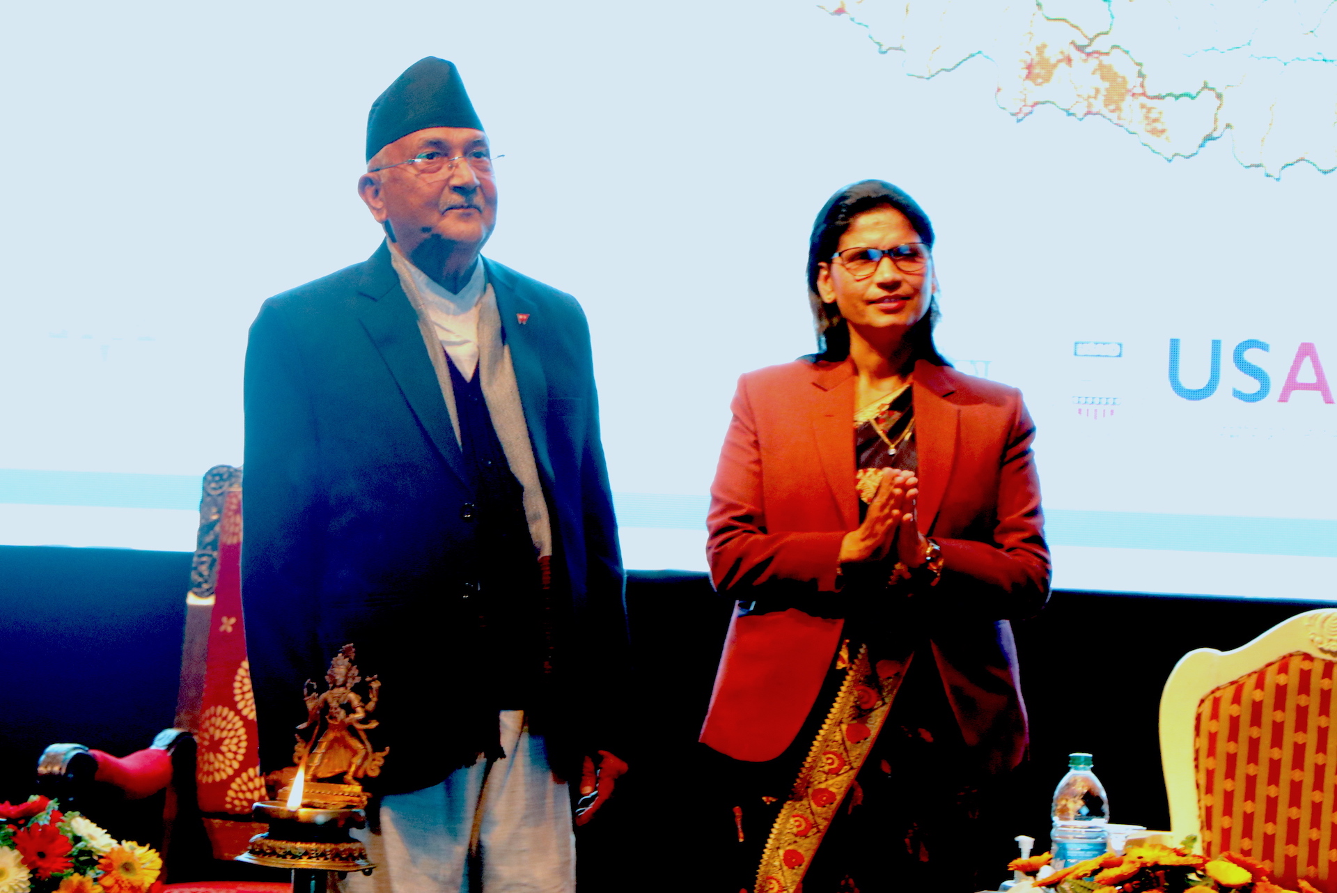
The Prime Minister of Nepal, K.P. Sharma Oli, officially launched the digital soil map at an event on February 24, 2021. Oli highlighted the benefits the map would bring to support soil fertility management in the digital era in Nepal. He emphasized its sustainability and intended use, mainly by farmers.

CIMMYT and NSSRC made a live demonstration of the digital soil map. They also developed and distributed an informative booklet that gives an overview of the map’s major features, operation guidelines, benefits, management and long-term plans.

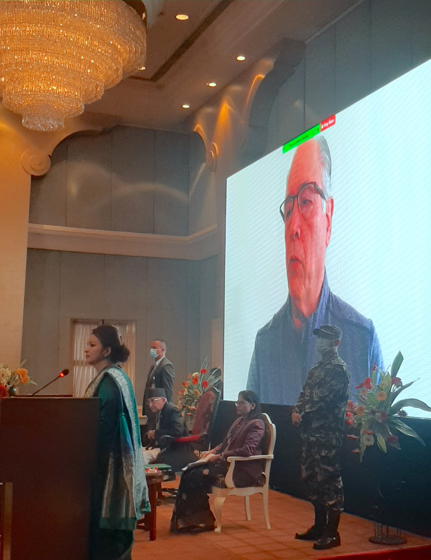
The launch event was led by the Ministry of Agriculture and Livestock Development and organized in coordination with NARC, as part of the Nepal Seed and Fertilizer (NSAF) project, implemented by CIMMYT. More than 200 people participated in the event, including government officials, policymakers, scientists, professors, development partner representatives, private sector partners and journalists. The event was also livestreamed.

Better decisions

Immediately after the launch of the digital soil map, its CPU usage grew up to 94%. Two days after the launch, 64 new accounts had been created, who downloaded different soil properties data in raster format for use in maps and models.

The new online resource was prepared using soil information from 23,273 soil samples collected from the National Land Use Project, Central Agricultural Laboratory and Nepal Agricultural Research Council. The samples were collected from 56 districts covering seven provinces. These soil properties were combined with environmental covariates (soil forming factors) derived from satellite data and spatial predictions of soil properties were generated using advanced machine learning tools and methods.

The platform is hosted and managed by NARC, who will update the database periodically to ensure its effective management, accuracy and use by local government and relevant stakeholders. The first version of the map was finalized and validated through a workshop organized by NSSRC among different stakeholders, including retired soil scientists and university professors.

Ivan Ortiz-Monasterio, principal scientist at CIMMYT, shared his remarks in a video message. (Photo: Shashish Maharjan/CIMMYT)

“The ministry can use the map to make more efficient management decisions on import, distribution and recommendation of appropriate fertilizer types, including blended fertilizers. The same information will also support provincial governments to select suitable crops and design extension programs for improving soil health,” said Padma Kumari Aryal, Minister of Agriculture and Livestock Development, who chaired the event. “The private sector can utilize the acquired soil information to build interactive and user-friendly mobile apps that can provide soil properties and fertilizer-related information to farmers as part of commercial agri-advisory extension services,” she said.

“These soil maps will not only help to increase crop yields, but also the nutritional value of these crops, which in return will help solve problems of public health such as zinc deficiency in Nepal’s population,” explained Ivan Ortiz-Monasterio, principal scientist at CIMMYT, in a video message.

Yogendra Kumar Karki, secretary of the Ministry of Agriculture and Livestock Development, presented the program objectives and Deepak Bhandari, executive director of NARC, talked about the implementation of the map and its sustainability. Special remarks were also delivered by USAID Nepal’s mission director, the secretary of Livestock, scientists and professors from Tribhuwan University, the International Fertilizer Development Center (IFDC) and the International Centre for Integrated Mountain Development (ICIMOD).

K.P. Sharma Oli (left), Prime Minister of Nepal, and Padma Kumari Aryal, Minister of Agriculture and Livestock Development, launch the digital soil map. (Photo: Shashish Maharjan/CIMMYT)

Benefits of digital soil mapping

Soil properties affect crop yield and production. In Nepal, access to soil testing facilities is rather scarce, making it difficult for farmers to know the fertilizer requirement of their land. The absence of a well-developed soil information system and soil fertility maps has been lacking for decades, leading to inadequate strategies for soil fertility and fertilizer management to improve crop productivity. Similarly, existing blanket-type fertilizer recommendations lead to imbalanced application of plant nutrients and fertilizers by farmers, which also negatively affects crop productivity and soil health.

This is where digital soil mapping comes in handy. It allows users to identify a domain with similar soil properties and soil fertility status. The digital platform provides access to domain-specific information on soil properties including soil texture, soil pH, organic matter, nitrogen, available phosphorus and potassium, and micronutrients such as zinc and boron across Nepal’s arable land.

Farmers and extension agents will be able to estimate the total amount of fertilizer required for a particular domain or season. As a decision-support tool, policy makers and provincial government can design and implement programs for improving soil fertility and increasing crop productivity. The map also allows users to identify areas with deficient plant nutrients and provide site-specific fertilizer formulations; for example, determining the right type of blended fertilizers required for balanced fertilization programs. Academics can also obtain periodic updates from these soil maps and use it as a resource while teaching their students.

As digital soil mapping advances, NSSRC will work towards institutionalizing the platform, building awareness at the province and local levels, validating the map, and establishing a national soil information system for the country.

Nepal’s digital soil map is readily accessible on the NSSRC web portal:
https://soil.narc.gov.np/soil/soilmap/

Power of data: To enhance food security

Data has become a key driver of growth and change in today’s world.

There is growing recognition that data is indispensable for effective planning and decision-making in every sector. But the state of digital data in developing countries is far from satisfactory. In Asia, monitoring the Sustainable Development Goals (SDGs) remains a challenge due to a lack of accurate data.

Read more: https://thehimalayantimes.com/opinion/power-of-data-to-enhance-food-security/

Toolkits to deal with Asian droughts

In July 2019 ICIMOD, along with its partners and the International Maize and Wheat Improvement Centre in Mexico, launched a web-based Regional Drought Monitoring and Outlook System for South Asia – an integrated information platform linking weather and climate data with agriculture practices in South Asia. The system provides multiple indices for droughts and seasonal weather outlooks, besides maps and baseline. Read more here.

Climate Services for Resilient Development in South Asia (CSRD)

Climate Services for Resilient Development (CSRD) is a global partnership that connects climate and environmental science with data streams to generate decision support tools and training for decision-makers in developing countries. Translating complex climate information into easy to understand actionable formats to spread awareness in the form of climate services is core to CSRD’s mission. CSRD works across South Asia (with emphasis on Bangladesh), the Horn of Africa (Ethiopia), and in South America (Colombia) to generate and provide timely and useful climate information, decision tools and services. In South Asia, CSRD focusses the development, supply and adaptation of agricultural climate services to reduce vulnerability by increasing resiliency in smallholder farming systems. These goals are strategically aligned with the Global Framework for Climate Services.

Project description

CSRD in South Asia aims to have the impact by increasing climate resilient farm management, indicated by increased use of climate services and climate information to inform farmers on how to better manage their production systems.  CSRD also aims to develop and validate models for agricultural climate services that can be replicated in other regions with similar farming systems and climate risks, while also fine-tuning weather and climate advisories to be most useful to farmers’ decision-making. A series of sustained contributions to CSRD’s Action and Learning Framework Pillars 1-4, detailed below, are envisioned as major project outcomes:

  • Pillar 1: Create the solution space:
    CSRD works to establish a problem-focus, to engage key stakeholders, to create a platform for sustained communication and collaboration, and to build synergies among relevant programs.
  • Pillar 2: Utilize quality data, products, and tools
    CSRD provides access to useful and available information and technology, and to develop tailored products and services responsive to problem-specific needs.
  • Pillar 3: Build capacities and platforms
    CSRD supports the use of targeted products and services, and to promote sustainability, scalability, and replicability.
  • Pillar 4: Build knowledge
    A key goal of CSRD’s work is to identify and promote good practices among the global climate services community and to support research efforts and innovation that increase the effectiveness of climate services.

Outputs

CSRD in South Asia will ultimately generate the following broad outputs and services:

Download the report summarizing CSRD activities, achievements, and challenges during the first year (from November 2016 through December 2017).

The CSRD consortium in South Asia is led by the International Maize and Wheat Improvement Center (CIMMYT) in partnership with the Bangladesh Meteorological Department (BMD), Bangladesh Department of Agricultural Extension (DAE), Bangladesh Agricultural Research Council (BARC), Bangladesh Agricultural Research Institute (BARI), International Center for Integrated Mountain Development (ICIMOD), International Institute for Climate and Society (IRI), University de Passo Fundo (UPF), and the University of Rhode Island (URI). This consortium provides strength and technical expertise to develop relevant climate products that can assist farmers and other stakeholders with relevant information to improve decision making, with the ultimate goal of increasing resilience to climate-related risks. The CSRD consortium also works to assure that climate information can be conveyed in ways that are decision-relevant to farmers and other agricultural stakeholders.

As a public-private partnership, CSRD is supported by the United States Agency for International Development (USAID), UK AID, the UK Met Office, the Asian Development Bank (ADB), the Inter-American Development Bank (IDB), ESRI, Google, the American Red Cross, and the Skoll Global Threats Fund.

New drought monitoring system will reduce climate risks for South Asian farmers

Farmers harvest squash in Uttarakhand, India. (Photo: Jitendra Raj Bajracharya/ICIMOD)

To mitigate the food security and economic risks of South Asia’s frequent and intense droughts, scientists and policymakers from the South Asian Association for Regional Cooperation (SAARC), the International Centre for Integrated Mountain Development (ICIMOD) and the International Maize and Wheat Improvement Center (CIMMYT) recently joined forces to launch an innovative decision support and agricultural planning system that combines remote sensing and  climate data analysis for drought monitoring and early warning.

The Regional Drought Monitoring and Outlook System application was unveiled during a workshop to train experts and policymakers in its use at relevant regional and national institutes in Islamabad, Pakistan, from July 29 to August 1, 2019. The Regional Drought Monitoring and Outlook System is the product of an ICIMOD-CIMMYT partnership through the United States Agency for International Development (USAID) and the National Aeronautics and Space Administration (NASA) supported SERVIR Hindu Kush Himalaya (HKH) programme, in collaboration with Climate Service for Resilient Development (CSRD), led by ICIMOD and CIMMYT, respectively.

“Commonly associated with epic flooding, particularly in the enormous breadbasket region known as the Indo-Gangetic Plains that extends across Pakistan, India, southern Nepal, and Bangladesh, the region also faces droughts driven by rising temperatures and erratic rainfall and which threaten crops, food security, and livelihoods,” said Faisal Mueen Qamer, Remote Sensing Specialist of ICIMOD, which helped develop the system and organize the workshop.

“We expect the system to foster resilience in South Asian agriculture, while supporting future institutional frameworks and policies for farm compensation and adaptation, through decision makers’ access to timely and action-oriented information,” Qamar explained.

With a growing population of 1.6 billion people, South Asia hosts 40% of the world’s poor and malnourished on just 2.4% of its land. A 2010 study found a linear drop of 7.5% in rainfall in South Asia from 1900 to 2005.

“Shrinking glaciers, water scarcity, rising sea levels, shifting monsoon patterns, and heat waves place considerable stress on South Asian countries, whose primary employment sector remains agriculture,” said Mohammad Faisal, Director General for South Asia at Pakistan’s Ministry of Foreign Affairs, during the workshop opening.

Media reports in early 2019 documented displacement and hunger from Pakistan’s worst drought in years.

Participants at the regional workshop on earth observation and climate data analysis for agriculture drought monitoring in South Asia. (Photo: ICIMOD)

Raising awareness about drought and its mitigation

Twenty-three participants from six South Asia countries plus five expert instructors attended the workshop, which offered presentations and hands-on training on a suite of applications and associated data analysis tools, including the South Asian Land Data Assimilation System (SALDAS), the Regional Drought Explorer, and the National Drought Early Warning System.

Muhammad Azeem Khan, Member of the Food Security & Climate Change at the Planning Commission of Pakistan, said the scale of present and future climate challenges is clearly evident.

“In Pakistan, we regularly see parts of the country in the grip of severe drought, while others have flash floods,” Khan commented during the workshop closing, while commending its organizers. “Frequent drought diminishes agricultural production and food security, especially for people in rural areas. Effectively managing the impacts of climate change requires a response that builds and sustains South Asia’s social, economic, and environmental resilience, as well as our emergency response capacity.”

Through CSRD, a global partnership that connects climate and environmental science with data streams to generate decision support tools and training for decision-makers in developing countries, CIMMYT helped extend the Regional Drought Monitoring and Outlook System to Bangladesh, from its original coverage of Afghanistan, Nepal, and Pakistan.

“Translating complex climate information into easy-to-understand and actionable formats is core to CSRD’s mission and helps spread awareness about climate challenges,” said Tim Krupnik, CIMMYT cropping systems agronomist based in Bangladesh. “This consortium provides strength and technical expertise to develop relevant climate products, including decision-support information for farmers and other stakeholders, thus fostering resilience to climate-related risks.”

On-the job training boosts drought monitoring skills in Bangladesh

A two-week on the job training took place in March on the application of remote sensing in drought monitoring and crop mapping in Kathmandu, Nepal to build the capacity of young and mid-career professionals. The training was organized with the support of the International Maize and Wheat Improvement Center (CIMMYT)-led Climate Services for Resilient Development (CSRD) initiative in South Asia, alongside the International Centre for Integrated Mountain Development (ICIMOD). The training introduced participants from Bangladesh’s apex agricultural research body, Bangladesh Agricultural Research Council (BARC), and the Bangladesh Agricultural Research Institute (BARI) to remote sensing techniques for monitoring and forecasting weather patterns.

Suraya Parvin (left), Senior Scientific Officer of BARC, discussing with the facilitator in the training. Photo: Jitendra Raj Bajracharya/ICIMOD.

The training strengthened the remote sensing capabilities of professionals from BARC and BARI in using satellite-based remote sensing tools and crop mapping to monitor drought risks. During the training, participants were exposed to a number of remote sensing and geographic information systems tools including SPIRITS, QGIS, ArcMap, GeoCLIM as well as a foundation course to Google Earth Engine. Additionally, open source platform to perform online and offline data collection using mobile application training was provided.This learning exchange took place in order to address the risks for agricultural drought in portions of north-western Bangladesh where farmers may lack access to, or cannot afford irrigation. This leads to bottlenecks in crop productivity and can impair the livelihoods of smallholder farmers reliant on variable and unpredictable precipitation. Access to quality drought monitoring and forecasting could assist farmers in adapting to these climactic risks. Meteorological and agricultural research institutions play a crucial role in providing improved information flow and drought risks advisories to farmers.

Mir Matin, theme leader of Geospatial Solutions, ICIMOD, organized the training on behalf of CSRD and ICIMOD, alongside Rajesh Bahadur Thapa, capacity building specialist, ICIMOD. ICIMOD’s Bhoj Raj also facilitated sessions on application of these tools.

“Bangladesh, especially the northern region, is most susceptible to drought and it is difficult to grow year-round crops here,” said Suraya Parvin, senior scientific officer of BARC. “To increase the cropping intensity in this region, drought monitoring is very essential. I think this training was extremely useful to prepare us for this challenge.”

The CSRD partnership and ICIMOD are working together to establish user-oriented platforms for the provision of easily accessible, timely and decision relevant scientific information, in the form of climate services. “This training, and the applied science products that will come from it, will be a crucial part of efforts to increase the resilience of Bangladesh’s smallholder farmers to climatic risks,” said Timothy J. Krupnik, systems agronomist, CIMMYT and CSRD project leader. “Working with the graduates of the training on a day-to-day basis, we expect to deepen BARC and BARI’s contributions to applied climate services in Bangladesh.”

CSRD is a global partnership whose core mission is to translate actionable climate information into easy to understand formats to spread awareness and use of climate services. The Climate Services for Resilient Development (CSRD)  consortium in South Asia is led by International Maize and Wheat Improvement Center (CIMMYT) in partnership with the Bangladesh Meteorological Department (BMD), Bangladesh Department of Agricultural Extension (DAE), the Bangladesh Agricultural Research Council (BARC), the Bangladesh Agricultural Research Institute (BARI), the International Centre for Integrated Mountain Development (ICIMOD), International Institute for Climate and Society (IRI), University de Passo Fundo (UPF), and the University of Rhode Island (URI). 

New initiative strengthens agricultural drought monitoring in Bangladesh

A new joint effort will strengthen or establish drought monitoring and early warning systems in Bangladesh. Photo: Santosh Raj Pathak/ICIMOD.

DHAKA, Bangladesh (CIMMYT) – A new joint effort will strengthen or establish drought monitoring and early warning systems in Bangladesh, as well as provide information on local cropping systems in South Asia to boost farmer resilience to climate change.

Regionally specific winter season drought and dry spells during the monsoon are a reoccurring concern in Bangladesh. Drought leads to reduced farming productivity, and climate change predictions suggest further decreases in precipitation in coming years. Additionally, there are uncertainties about where monsoons will flood in the rainy season, limiting groundwater recharge. If farmers are unable to adapt to these changes, bottlenecks in crop productivity and increased food insecurity are likely to result.

The effort will be led by Climate Services for Resilient Development (CSRD) and SERVIR-Hindu Kush Himalaya – a project funded by the United States Agency for International Development (USAID) – using Earth observation data.

A workshop jointly hosted by a number of organizations was recently held at the Bangladesh Agriculture Research Council (BARC) campus in Dhaka, Bangladesh to discuss the development of these agricultural monitoring services. The workshop brought together key partners to discuss anticipated methods, work plans and the user engagement process for effective development and long-term sustainability of the agricultural drought monitoring service.

Under this partnership, BARC is working to strengthen capacity of national research and agricultural extension institutes to use geographic information systems and remote sensing approaches for drought risk management.

(L-R) Birendra Bajracharya, regional program manager at the International Centre for Integrated Mountain Development, Shams Uddin Ahmed, director of the Bangladesh Meteorological Department, Muhammad Jalal Uddin, executive chairman the Bangladesh Agriculture Research Council and Timothy J. Krupnik, CIMMYT systems agronomist. Photo: Santosh Raj Pathak/ICIMOD

Shams Uddin Ahmed, director of the Bangladesh Meteorological Department, noted that groundwater accessibility is a growing concern due to continued drought. The government has posed restrictions on deep well extraction, except for drinking water, to conserve crucial groundwater resources. He added that access to good quality drought monitoring and early warning information could help develop climate services to help farmers adapt to these challenges.

Muhammad Jalal Uddin, executive chairman of BARC, emphasized the need to adopt new technologies including remote sensing applications to improve predictability of climate hazards like floods and droughts. He added that with the adoption of improved agricultural practices, Bangladesh has become self-sufficient in rice, but that further work is needed to attain overall nutrition sufficiency.

Promoting and enabling climate services that increase farmer resilience to the impacts of climate variability can positively change behaviors and affect policy in developing countries. To do this, collaborators are working together to establish information communication technology platforms to provide user-oriented, easily accessible, timely and decision-relevant scientific information in the form of climate services.

Birendra Bajracharya, regional program manager of the Mountain Environment Regional Information System program at the International Centre for Integrated Mountain Development (ICIMOD), highlighted opportunities of using Earth observation data products for addressing societal challenges. He emphasized the user-centric “services” used by ICIMOD increase the sustainable use of Earth observation information and geospatial technologies for environmental management and improve resilience to climate change in the region.

Read the full workshop summary from ICIMOD here.

CSRD is a a public-private partnership supported by USAID, Department for International Development (DFID), the Met Office, Asian Development Bank, the Inter-American Development Bank, ESRI, Google, the American Red Cross and the Skoll Global Threats Fund.